
Bělá nad Radbuzou
| Bělá nad Radbuzou | |||||
|---|---|---|---|---|---|
|
|||||
| Basic data | |||||
| State : |
|
||||
| Region : | Plzeňský kraj | ||||
| District : | Domažlice | ||||
| Area : | 8330.7921 ha | ||||
| Geographic location : | 49 ° 36 ' N , 12 ° 43' E | ||||
| Height: | 442 m nm | ||||
| Residents : | 1,745 (Jan 1, 2019) | ||||
| Postal code : | 345 25 - 345 26 | ||||
| License plate : | P | ||||
| traffic | |||||
| Railway connection: | Domažlice – Tachov | ||||
| structure | |||||
| Status: | city | ||||
| Districts: | 12 | ||||
| administration | |||||
| Mayor : | Libor Picka (as of 2007) | ||||
| Address: | Náměstí 200 345 26 Bělá nad Radbuzou |
||||
| Municipality number: | 553441 | ||||
| Website : | www.sumavanet.cz/bela | ||||


Bělá nad Radbuzou (German Weißensulz ) is a town in Plzeňský kraj (Pilsen region) in the Czech Republic . It is located at the confluence of the Bezděkovský potok ( Pössigkauer Bach ) in the Radbuza (Radbusa) in the west of Bohemia, about ten kilometers east of the Bavarian market Eslarn and belongs to the Okres Domažlice (district of Taus) . There is a border crossing to Eslarn in the district of Železná (Eisendorf) .
Neighboring communities
The neighboring communities (clockwise) are: Třemešné (Zemschen) , Stráž (Neustadtl) , Hostouň (Hostau) , Mutěnín (Muttersdorf) , Rybník (Waier) , Stadlern , Schönsee and Eslarn .
|
Eslarn 16 km |
Třemešné (Zemschen) 5 km |
Stráž (New Town) 12 km |
|
Schönsee 24 km |
.svg)
|
Hostouň (Hostau) 8 km |
|
Stadlern 31 km |
Rybník (Waier) 13 km |
Mutěnín (Muttersdorf) 10 km |
history
The first report about the place can be found in the Chronica Boemorum des Cosmas of Prague , in which it can be read that Duke Vladislav I had a German castle destroyed near Bela in 1121. Bela was a Chodian settlement on the border with the Nordgau (Bavaria) and had significant privileges as a border guard. Since the 14th century, there was an increasing influx of German-speaking new settlers and the name Weißensulz came into being.
The railway line Domažlice (Taus) - Tachov (Tachau) - Planá u Mariánských Lázní (Plan / Marienbad) runs through the village . From an administrative point of view, Bělá nad Radbuzou (Weißensulz) formed a municipality in the judicial district of Hostau or in the Bischofteinitz district from the middle of the 19th century . In 1875 the community was raised to a market town. The lower bridge over the Radbuza (Rabusa) is a replica of Prague's Charles Bridge with figures of saints.
Bělá nad Radbuzou (white brine) belonged to the Kingdom of Bohemia as part of Austria-Hungary until the end of the First World War in 1918 . After the collapse of the dual monarchy, it belonged to Czechoslovakia . In the Munich Agreement , the place was added to the German Reich and until 1945 belonged to the district of Bischofteinitz in the so-called Sudetenland .
During the Second World War, the mayor Ferdinand Wild prevented this cultural monument from being blown up. The group of companies of the Wild families, based in Eisendorf and Weißensulz since 1648, a company for embroidery and lace products, counted princely and royal families among their customers after the World Exhibition in Vienna in 1873. In 1945, on the basis of the Beneš decrees , the Wild family were expropriated and expelled along with the German residents of the village . In Boxberg, Baden in West Germany, production started over.
Community structure
The town Bela nad Radbuzou (Weißensulz) consists of the districts Bela nad Radbuzou (Weißensulz) , Bystřice (Wistersitz) , Čečín (Zetschin) , Cerna Hora (Tschernahora) , Doubravka (Dobraken) , Hleďsebe (Siehdichfür) , Karlova Huť (Karlsbach hut) , Nový Dvůr (Neuhof) , Pleš (Plöß) , Smolov (Schmolau) , Újezd Svatého Kříže (Heiligenkreuz near Weißensulz) and Železná (Eisendorf) .
Basic development units are bělá nad radbuzou (Weißensulz) , Bystřice (Wistersitz) , Čečín (Zetschin) , Černá Hora (Tschernahora) , Doubravka (Dobraken) , Karlova Huť (Karlsbach hut) , Novy Dvur (Neuhof) , Pleš (Plöß) , Smolov (Schmolau ) , Újezd Svatého Kříže (Holy Cross near White Sulz) .
The urban area is divided into the cadastral districts Bělá nad Radbuzou, Bystřice u Bělé nad Radbuzou, Čečín, Černá Hora u Bělé nad Radbuzou, Doubravka u Bělé nad Radbuzou, Pleš, Smolov, Újezd Svatéá and Smolov.
The villages of Lískovec (Haselberg) and Růžov (Rosendorf) , which disappeared after 1945, are located in the corridors of Bělá nad Radbuzou (white brine) .

Culture and sights
The stone bridge over the Radbuza was built between 1703 and 1723 at the suggestion of Anna Marie Terezie Metternich, owner of the Bela estate. It replaced a previously existing wooden bridge. The bridge has eight arches and six piers. Each pillar is adorned with a figure of a saint.
The figures on the west side represent from north to south:
- the Holy Mary of the Immaculate Conception
- the Saint Wenceslas , patron saint of Bohemia
- the holy Erazim or Erasmus
The figures on the east side represent from north to south:
- the Archangel Michael
- St. John Nepomuk
- Saint Anthony of Padua
The bridge was closed to car traffic in 1995 as an important monument worthy of protection and today (2013) can only be used by pedestrians and cyclists.

Figure of St. Mary of the Immaculate Conception on the stone bridge in Bělá nad Radbuzou

Figure of St. Wenceslas on the stone bridge in Bělá nad Radbuzou
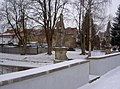
Figure of St. Erazim on the stone bridge in Bělá nad Radbuzou

Figure of St. Michael the Archangel on the stone bridge in Bělá nad Radbuzou

Figure of St. Nepomuk on the stone bridge in Bělá nad Radbuzou

Figure of St. Anthony on the stone bridge in Bělá nad Radbuzou


From about 3.5 km to the southeast lies Újezd Svatého Kříže (Holy Cross) Tillyschanz - her Jakobstrail Prague comes. After Bělá nad Radbuzou (white brine) it continues in a westerly direction to Nový Dvůr (Neuhof) 2.5 km away . It is marked with I24 and is called Svatojakubská cesta in Czech.
Twin cities
- Eslarn , Germany
Personalities
- Jan Smudek (1915–1999), anti-fascist and anti-communist resistance fighter
- Hans Drachsler (1916–1996), German politician (CSU).
Web links
Individual evidence
- ↑ http://www.uir.cz/obec/553441/Bela-nad-Radbuzou
- ↑ Český statistický úřad - The population of the Czech municipalities as of January 1, 2019 (PDF; 7.4 MiB)
- ↑ Our home district of Bischofteinitz with the German settlements in the district of Taus, published by the home district of Bischofteinitz, Furth im Wald, 1967, in it: House chronicle of the Wild family of manufacturers in Eisendorf (Zelezna) and Weißensulz.
- ↑ Erikationsbuch of the Heiligenkreuz Archives in West Bohemia
- ↑ http://www.uir.cz/casti-obce-obec/553441/Obec-Bela-nad-Radbuzou
- ↑ http://www.uir.cz/zsj-obec/553441/Obec-Bela-nad-Radbuzou
- ↑ http://www.uir.cz/katastralni-uzemi-obec/553441/Obec-Bela-nad-Radbuzou
- ↑ Information board on the bridge
- ↑ http://www.jakobus-info.de/ultreia/tschechien.htm
- ↑ Český les jih Turistická mapa. VKU akciová spoločnost´, Harmanec 2004
- ↑ http://jakobswege-nach-burgund.de/Prag-Eslarn/
| Districts |
Bela nad Radbuzou (Weißensulz) • Bystřice (Wistersitz) • Čečín (Zetschin) • Cerna Hora (Tschernahora) • Doubravka (Dobraken) • Hleďsebe (Siehdichfür) • Karlova Huť (Karlsbach hut) • Novy Dvur (Neuhof) • Pleš (Plöß) • Smolov (Schmolau) • Újezd Svatého Kříže (Holy Cross near Weißensulz) • Železná ( Iron Village ) |
| Desolation |
Buchar (beech mill) • Cihlářské Domky ( brickworks ) • Eisendorfská Huť, Železná Hut ' (Eisendorfhütte) • Engelmühle (Engelmühle) • Frančina Huť (Franzelhütte) • Gailschlag - brusírna skla ( Gailschlagschleife ) • Hamry (hammer mill) • Hankasova pila (hammer mill) • Holy cross mill (Holy cross mill) • Horni Hamr - Brusírna skla (upper - hammer) • Lískovec (Costanosellari) • Mühldicke (Mühldicke) • Novodvorsky mlýn (Neuhofer mill) • Pila Novy Dvur (Erlbachsäge) • Rabov (Rappauf) • Ruštejn ( Ruhstein) • Růžov (Rose village) • Růžovský mlýn (Rose mill) • Black Weyer (Black Weyer) • Straška Huť (Strass huts) • Újezd svatého Kříže - zámek (Heiligenkreuz- lock) • Václav (Wenzel village) • Vésky mlýn (village mill) • forest chapel (Forest Chapel) • Waldorf (Waldorf) • Zankmühle |