
Rusio
| Rusio | ||
|---|---|---|
|
||
| region | Corsica | |
| Department | Upper Corsica | |
| Arrondissement | Corte | |
| Canton | Golo-Morosaglia | |
| Community association | Pasquale Paoli | |
| Coordinates | 42 ° 22 ′ N , 9 ° 16 ′ E | |
| height | 640-1,585 m | |
| surface | 8.58 km 2 | |
| Residents | 71 (January 1, 2017) | |
| Population density | 8 inhabitants / km 2 | |
| Post Code | 20244 | |
| INSEE code | 2B264 | |
 Rusio with the San Petrone |
||

Rusio is a municipality on the French island of Corsica . It belongs to the Haute-Corse department , the Corte arrondissement and the Golo-Morosaglia canton . The residents call themselves Rusinchi .
geography
Rusio is located at about 950 meters above sea level in the Corsican mountains. Neighboring municipalities are Omessa and Lano in the northwest, Érone in the north, Cambia in the northeast, Carticasi in the east, Sermano in the southeast, Castellare-di-Mercurio in the south and Santa-Lucia-di-Mercurio and Tralonca in the southwest. Local elevations are the San Petrone (1767 m) and the Pianu Maiò (1581 m). Streams that flow through Rusio are called Calcinaju, Busincu, Vituste, and Tovuli.
Population development
| year | 1962 | 1968 | 1975 | 1982 | 1990 | 1999 | 2008 | 2012 |
|---|---|---|---|---|---|---|---|---|
| Residents | 99 | 108 | 100 | 83 | 57 | 66 | 77 | 79 |
Attractions
- Sainte-Marie church
- Saint-Just Chapel
- Chapel of San Cervone
- Saint-Alexis Chapel

Sainte-Marie church

Personalities
- Anna Rocchi, singer
- Charles Rocchi, singer, * 1920, † 2010
- Philippe Rocchi, singer, nephew of Charles Rocchi
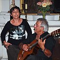
Anna Rocchi accompanied by a guitarist
