Champaign County (Illinois)
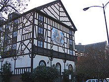
 Champaign County Courthouse |
|
| administration | |
|---|---|
| US state : | Illinois |
| Administrative headquarters : | Urbana |
| Address of the administrative headquarters: |
Brookens Admin. Center 1776 E. Washington St. Urbana, IL 61802-4581 |
| Foundation : | February 20, 1833 |
| Made up from: | Vermilion County |
| Area code : | 001 217 |
| Demographics | |
| Residents : | 201,081 (2010) |
| Population density : | 77.9 inhabitants / km 2 |
| geography | |
| Total area : | 2584 km² |
| Water surface : | 2 km² |
| map | |
| Website : www.co.champaign.il.us | |
The Champaign County is a county in the US -amerikanischen State Illinois . In 2010 the county had 201,081 residents and a population density of 77.9 people per square kilometer. The county seat is Urbana .
geography
Champaign County, where the Embarras Rivers and Kaskaskia Rivers arise, is located in eastern Illinois. It has a total area of 2,584 square kilometers , of which two square kilometers are water. The county is in the shape of a rectangle, the north-south extent of which is exactly 36 miles and the east-west extent of which is about 28 miles. The following neighboring counties border Champaign County:
| McLean County | Ford County | |
| Piatt County |

|
Vermilion County |
| Douglas County | Edgar County |
history
Champaign County was established in 1833 and was formerly part of Vermilion County. The county and the seat of the county administration were named after the Champaign County in Ohio and its capital Urbana , since the member of the state parliament who introduced the application for the establishment of a county came from this part of Ohio.
The county's development was greatly advanced with the arrival of the Illinois Central Railroad , which linked Chicago and Cairo . Even more important for the development of the county was the settlement of the "Land-Grant" University , the University of Illinois in 1867.
With the closure of the Chanute Air Training Center in Rantoul in the 1990s, the northern part of the county suffered a major economic and demographic setback.
Although Republicans had had a district majority since the mid-19th century, the 2000 elections were the first time the Democrats won a majority they have been able to defend since then. In the 2004 US presidential election , Champaign County was one of only 15 of 102 counties in Illinois where John Kerry won a majority (50.5 percent) of the vote.
Demographic data
| Population development | |||
|---|---|---|---|
| Census | Residents | ± in% | |
| 1840 | 1475 | - | |
| 1850 | 2649 | 79.6% | |
| 1860 | 14,629 | 452.2% | |
| 1870 | 32,737 | 123.8% | |
| 1880 | 40,863 | 24.8% | |
| 1890 | 42,159 | 3.2% | |
| 1900 | 47,622 | 13% | |
| 1910 | 51,829 | 8.8% | |
| 1920 | 56,959 | 9.9% | |
| 1930 | 64.273 | 12.8% | |
| 1940 | 70,578 | 9.8% | |
| 1950 | 106,100 | 50.3% | |
| 1960 | 132,436 | 24.8% | |
| 1970 | 163.281 | 23.3% | |
| 1980 | 168,392 | 3.1% | |
| 1990 | 173.025 | 2.8% | |
| 2000 | 179,669 | 3.8% | |
| 2010 | 201.081 | 11.9% | |
| Before 1900 1900–1990 2000 2010 | |||

According to the 2010 census , Champaign County had 201,081 people in 76,361 households. The population density was 77.9 inhabitants per square kilometer. Statistically, 2.26 people lived in each of the 76,361 households.
The racial the population was composed of 73.4 percent white, 12.4 percent African American, 0.3 percent Native American, 8.9 percent Asian and other ethnic groups; 2.7 percent were descended from two or more races. Hispanic or Latino of any race was 5.3 percent of the population.
19.4 percent of the population were under 18 years old, 70.6 percent were between 18 and 64 and 10.0 percent were 65 years or older. 50.1 percent of the population was female.
The median income for a household was 42,101 USD . The per capita income was $ 23,495. 19.9 percent of the population lived below the poverty line.
Localities in Champaign County
1 - partly in Vermilion County
2 - partly in Douglas County
structure
Champaign County is divided into 30 townships :
|
|
|
1 corresponds to the city of Champaign
See also
Individual evidence
- ↑ GNIS-ID: 424211. Retrieved on February 22, 2011 (English).
- ↑ a b c U.S. Census Bureau, State & County QuickFacts - Champaign County, IL Retrieved November 21, 2012
- ^ A b National Association of Counties.Retrieved November 21, 2012
- ^ US Census Bureau - Census of Population and Housing.Retrieved March 15, 2011
- ↑ Extract from Census.gov . Retrieved February 14, 2011
- ↑ Extract from the National Register of Historic Places - No. 06000778.Retrieved December 14, 2011
- ↑ Extract from the National Register of Historic Places - No. 03001201. Accessed December 14, 2011
- ↑ Missouri Census Data Center - Illinois ( page no longer available , search in web archives ) Info: The link was automatically marked as defective. Please check the link according to the instructions and then remove this notice. Retrieved November 21, 2012
Web links
Coordinates: 40 ° 8 ′ N , 88 ° 12 ′ W


