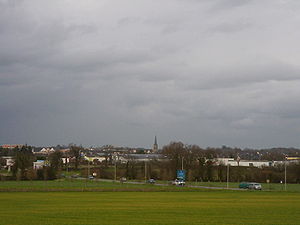
Chantepie
|
Chantepie Kantpig |
||
|---|---|---|
|
|
||
| region | Brittany | |
| Department | Ille-et-Vilaine | |
| Arrondissement | Rennes | |
| Canton | Rennes-3 | |
| Community association | Rennes metropolis | |
| Coordinates | 48 ° 5 ′ N , 1 ° 37 ′ W | |
| height | 32-77 m | |
| surface | 11.98 km 2 | |
| Residents | 10,435 (January 1, 2017) | |
| Population density | 871 inhabitants / km 2 | |
| Post Code | 35135 | |
| INSEE code | 35055 | |
| Website | http://www.ville-chantepie.fr/ | |
 Look at Chantepie |
||
Chantepie ( Breton : Kantpig ) is a commune with 10,435 inhabitants (as of January 1 2017) in the department of Ille-et-Vilaine in the region of Brittany . It belongs to the Arrondissement of Rennes , the canton of Rennes-3 and is a member of the Rennes Métropole municipal association . The inhabitants are called Cantepien (ne) s .
geography
The community is located in the greater area a few kilometers southeast of Rennes . The neighboring municipalities of Chantepie are Cesson-Sévigné in the north, Domloup in the east, Vern-sur-Seiche in the south, Noyal-Châtillon-sur-Seiche in the west and Rennes in the north-west.
population
| year | 1806 | 1846 | 1906 | 1954 | 1962 | 1968 | 1975 | 1982 | 1990 | 1999 | 2006 | 2017 |
|---|---|---|---|---|---|---|---|---|---|---|---|---|
| Residents | 796 | 900 | 709 | 1,018 | 1.310 | 1,594 | 2,651 | 3,677 | 5,898 | 6,793 | 7,852 | 10,435 |
Attractions
- Saint-Martin-de-Tours church
Community partnerships
A partnership has existed with the German community of Obrigheim in Baden-Württemberg since 1998.
Another partnership exists with the municipality of Krško in the Slovenian region of Spodnjeposavska ( Lower Sava ).
Trivia
Euro banknotes with an “E” in the number are printed in the François Charles Oberthur Fiduciaire printing house in Chantepie.
literature
- Le Patrimoine des Communes d'Ille-et-Vilaine. Flohic Editions, Volume 2, Paris 2000, ISBN 2-84234-072-8 , pp. 1197-1200.

