Acigné
|
Acigné Egineg |
||
|---|---|---|

|
|
|
| region | Brittany | |
| Department | Ille-et-Vilaine | |
| Arrondissement | Rennes | |
| Canton | Liffré | |
| Community association | Rennes metropolis | |
| Coordinates | 48 ° 8 ′ N , 1 ° 32 ′ W | |
| height | 29-96 m | |
| surface | 29.55 km 2 | |
| Residents | 6,740 (January 1, 2017) | |
| Population density | 228 inhabitants / km 2 | |
| Post Code | 35690 | |
| INSEE code | 35001 | |
| Website | http://www.ville-acigne.fr/ | |
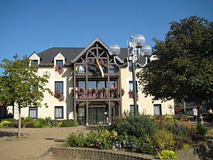
 Acigné town hall |
||
Acigné ( Breton : Egineg ) is a municipality with 6740 inhabitants (as of January 1 2017) in the department of Ille-et-Vilaine in the region of Brittany in northwest France . The municipality belongs to the Arrondissement of Rennes and the canton of Liffré . The inhabitants are called Acignolais .
geography
Acigné is about ten kilometers east of Rennes on the Vilaine , into which the Veuvre flows here. Acigné is surrounded by the neighboring municipalities of Liffré in the north, La Bouëxière in the northeast, Servon-sur-Vilaine in the east, Brécé in the southeast, Noyal-sur-Vilaine in the south, Cesson-Sévigné in the west and Thorigné-Fouillard in the northwest.
history
In the fourth century, according to legend, the area was Christianized by Martin of Tours .
| year | 1962 | 1968 | 1975 | 1982 | 1990 | 1999 | 2006 | 2017 |
|---|---|---|---|---|---|---|---|---|
| Residents | 1,557 | 1,776 | 2,319 | 3,554 | 4,361 | 5,246 | 5,785 | 6,740 |
Attractions
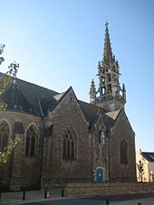
- Saint-Martin-de-Tours church, built in 1904
- Château des Onglées, Monument historique since 2012
- Acigné watermill
Community partnerships
Acigné has partnerships with the following municipalities:
- Wachtendonk , North Rhine-Westphalia, Germany
- Șeica Mare , Transylvania, Romania
literature
- Le Patrimoine des Communes d'Ille-et-Vilaine. Flohic Editions, Volume 1, Paris 2000, ISBN 2-84234-072-8 , pp. 289-300.

