Chasne-sur-Illet
|
Chasné-sur-Illet Kadeneg |
||
|---|---|---|

|
|
|
| region | Brittany | |
| Department | Ille-et-Vilaine | |
| Arrondissement | Rennes | |
| Canton | Liffré | |
| Community association | Liffré-Cormier Community | |
| Coordinates | 48 ° 15 ′ N , 1 ° 34 ′ W | |
| height | 39-81 m | |
| surface | 9.47 km 2 | |
| Residents | 1,537 (January 1, 2017) | |
| Population density | 162 inhabitants / km 2 | |
| Post Code | 35250 | |
| INSEE code | 35067 | |
| Website | http://www.chasnesurillet.fr/ | |
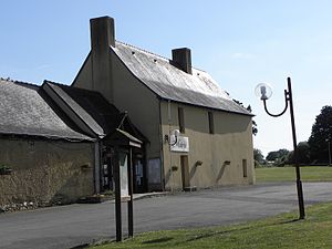
 Town hall (Mairie) of Chasné-sur-Illet |
||
Chasné-sur-Illet ( Breton : Kadeneg ; Gallo : Chasnaé ) is a French municipality with 1537 inhabitants (as of January 1 2017) in the department of Ille-et-Vilaine in the region of Brittany ; it belongs to the Arrondissement of Rennes and the canton of Liffré . The inhabitants are called Chasnéens .
geography
Chasné-sur-Illet is located about 15 kilometers north-northeast of Rennes on the Illet river , which borders the municipality in the north-west. Chasné-sur-Illet is surrounded by the neighboring communities of Saint-Aubin-d'Aubigné in the north and northwest, Ercé-près-Liffré in the northeast, Liffré in the east and southeast, Saint-Sulpice-la-Forêt in the south and Mouazé in the west and Southwest.
Population development
| year | 1962 | 1968 | 1975 | 1982 | 1990 | 1999 | 2006 | 2017 |
| Residents | 431 | 415 | 540 | 866 | 882 | 1139 | 1372 | 1357 |
| Sources: Cassini and INSEE | ||||||||
Attractions
- Saint-Martin-de-Tours church from the 12th century, alterations from the 18th and 19th centuries. century
literature
- Le Patrimoine des Communes d'Ille-et-Vilaine. Flohic Editions, Volume 1, Paris 2000, ISBN 2-84234-072-8 , pp. 789-792.
Web links
Commons : Chasné-sur-Illet - Collection of images, videos and audio files

