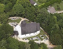
La Vacherie
| La Vacherie | ||
|---|---|---|
|
|
||
| region | Normandy | |
| Department | Your | |
| Arrondissement | Les Andelys | |
| Canton | Pont-de-l'Arche | |
| Community association | His-yours | |
| Coordinates | 49 ° 8 ' N , 1 ° 9' E | |
| height | 26-144 m | |
| surface | 7.63 km 2 | |
| Residents | 568 (January 1, 2017) | |
| Population density | 74 inhabitants / km 2 | |
| Post Code | 27400 | |
| INSEE code | 27666 | |
La Vacherie (French for the cowshed is) a French village with 568 inhabitants (as of January 1 2017) in the Eure in the region of Normandy ; it belongs to the arrondissement of Les Andelys and the canton of Pont-de-l'Arche (until 2015: canton of Louviers-Sud ).
The Menhir de la Vacherie is located in Donges in the Loire-Atlantique department .
geography
La Vacherie is about eleven kilometers north of Évreux on the small river Ilton . La Vacherie is surrounded by the neighboring communities of Hondouville in the north and north-west, Acquigny in the north and north-east, Heudreville-sur-Eure in the east, La Chapelle-du-Bois-des-Faulx in the south-east, Émalleville in the south and south-east, Brosville in the south and Southwest and Houetteville to the west.
Population development
| year | 1962 | 1968 | 1975 | 1982 | 1990 | 1999 | 2006 | 2013 |
| Residents | 151 | 162 | 176 | 279 | 423 | 485 | 540 | 560 |
| Sources: Cassini and INSEE | ||||||||

