
Raon-l'Étape
| Raon-l'Étape | ||
|---|---|---|

|
|
|
| region | Grand Est | |
| Department | Vosges | |
| Arrondissement | Saint-Dié-des-Vosges | |
| Canton | Raon-l'Étape (main town) | |
| Community association | Saint-Dié-des-Vosges | |
| Coordinates | 48 ° 24 ' N , 6 ° 50' E | |
| height | 279-610 m | |
| surface | 23.71 km 2 | |
| Residents | 6,388 (January 1, 2017) | |
| Population density | 269 inhabitants / km 2 | |
| Post Code | 88110 | |
| INSEE code | 88372 | |
| Website | http://www.raonletape.fr/ | |
 Location of Raon-l'Étape in the Vosges department |
||

Raon-l'Étape is a French commune with 6,388 inhabitants (as of January 1, 2017) in the Vosges department in the Grand Est region (until 2015 Lorraine ). It is the main town (chef-lieu) of the canton of the same name in the arrondissement of Saint-Dié-des-Vosges .
geography
Raon-l'Étape is located at the confluence of the Plaine in the Meurthe . Saint-Dié-des-Vosges is 17, Épinal 44, Nancy 69 and Strasbourg 88 kilometers away. Forests take up almost 60% of the municipal area. The Vallée de la Plaine begins at Raon-l'Étape .
history
The place was called in the 13th century "Ravon" - that means "confluence".
Population development
| year | 1962 | 1968 | 1975 | 1982 | 1990 | 1999 | 2007 | 2017 |
| Residents | 7606 | 7696 | 7741 | 7039 | 6780 | 6749 | 6710 | 6388 |
Attractions

The Plaine in Raon-l'Étape

Saint-Luc church

town hall

Fountain "Goat of Raon-l'Étape"
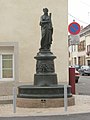
"La Concorde" fountain


economy
In addition to trade and small businesses, industry was also settled: paper mills, foundries, mechanical engineering, plastics, textiles, clothing, telecommunications and other branches of industry.
Sports
The local soccer club US Raon plays in the soccer championship for amateur teams and plays its home games at the Stade Paul Gasser .