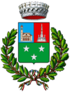
San Fermo della Battaglia
| San Fermo della Battaglia | ||
|---|---|---|

|
|
|
| Country | Italy | |
| region | Lombardy | |
| province | Como (CO) | |
| Coordinates | 45 ° 49 ' N , 9 ° 3' E | |
| height | 397 m slm | |
| surface | 5.78 km² | |
| Residents | 7,859 (Dec. 31, 2019) | |
| Population density | 1,360 inhabitants / km² | |
| Post Code | 22020 | |
| prefix | 031 | |
| ISTAT number | 013206 | |
| Popular name | sanfermesi | |
| Patron saint | Saint Fermo ( August 9th ) | |
| Website | San Fermo della Battaglia | |
San Fermo della Battaglia is a municipality with 7859 inhabitants (as of December 31, 2019) in the Italian province of Como in the Lombardy region .
geography
The municipality is located near the border with Switzerland on Strada provinciale 17 (provincial road) between Cavallasca and Como and is affected by the A9 autostrada . The neighboring communities are: Chiasso in the canton of Ticino in Switzerland, Como, Gironico , Colverde and Montano Lucino .
history
The municipality was called Vergosa until 1911 . The place got the addition Battaglia due to the battle of San Fermo that took place here .
On January 1, 2017, the previously independent municipality of Cavallasca was incorporated.
Demographic development
Data from ISTAT

Attractions
- San Fermo e Lorenzo Sanctuary (1565)
- Santa Maria Immacolata Church (1778)
literature
- Anna Ferrari-Bravo, Paola Colombini: Guida d'Italia. Lombardia (esclusa Milano). Milano 1987, p. 268.
- Lombardia - Touring club italiano, Touring Editore (1999), ISBN 88-365-1325-5 , San Fermo della Battaglia Online
Web links
Commons : San Fermo della Battaglia - Collection of images, videos and audio files
Individual evidence
- ↑ Statistiche demografiche ISTAT. Monthly population statistics of the Istituto Nazionale di Statistica , as of December 31 of 2019.
- ↑ San Fermo e Lorenzo pilgrimage church (photo) on lombardiabeniculturali.it/
- ↑ Church of Santa Maria Immacolata (photo) on lombardiabeniculturali.it, accessed July 29, 2015.


