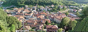
Oltrona di San Mamette
| Oltrona di San Mamette | ||
|---|---|---|

|
|
|
| Country | Italy | |
| region | Lombardy | |
| province | Como (CO) | |
| Local name | Ultrona | |
| Coordinates | 45 ° 45 ' N , 8 ° 59' E | |
| height | 370 m slm | |
| surface | 2.69 km² | |
| Residents | 2,404 (Dec 31, 2019) | |
| Population density | 894 inhabitants / km² | |
| Post Code | 22070 | |
| prefix | 031 | |
| ISTAT number | 013169 | |
| Popular name | Oltronesi | |
| Patron saint | John the Baptist ( August 29 ) | |
| Website | Oltrona di San Mamette | |
Oltrona di San Mamette is a northern Italian municipality ( comune ) with 2404 inhabitants (as of December 31, 2019) in the province of Como in Lombardy .
geography
The municipality is located about 10.5 kilometers southwest of Como on the Antiga , a tributary of the Olona and includes the fractions: Cerc , Gerbo (Zerbo). The neighboring municipalities are: Appiano Gentile , Beregazzo con Figliaro , Lurate Caccivio , Olgiate Comasco .
Attractions
- Parish Church of San Giovanni Decollato (1777)
- San Mamette pilgrimage church (11th century-built 1960)
Personalities
- Carlo Ferrario (1835–1912), volunteer in the Piedmontese army.
literature
- Oltrona di San Mamette on tuttitalia.it/lombardia
Web links
Commons : Oltrona di San Mamette - Collection of images, videos and audio files
Individual evidence
- ↑ Statistiche demografiche ISTAT. Monthly population statistics of the Istituto Nazionale di Statistica , as of December 31 of 2019.
- ↑ Parish Church of San Giovanni Decollato (photo)
- ↑ San Mamette pilgrimage church (photo)


