Schönau (pass)
| Schönau | |||
|---|---|---|---|
|
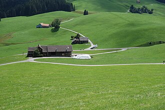
Pass height below Hochhamm |
|||
| Compass direction | west | east | |
| Pass height | 1066 m above sea level M. | ||
| Canton | Canton of St. Gallen | Canton of Appenzell Ausserrhoden | |
| Watershed | Necker , Thur | Urnäsch , sitter | |
| Valley locations | Bächli SG | Urnaesch | |
| expansion | Pass road | ||
| Mountains | Appenzell Alps | ||
| profile | |||
| Ø pitch | 4.2% (212 m / 5 km) | 7.8% (234 m / 3 km) | |
| Map (Canton of St. Gallen) | |||
|
|
|||
| Coordinates | 736 338 / 241426 | ||
The Schönau pass (short: Schönau) is a pass in the Swiss canton of Appenzell Ausserrhoden in the municipality of Urnäsch between Urnäsch and Bächli canton of St. Gallen . It connects the Neckertal with the Urnäschtal .
The pass height is 1066 m above sea level. M. at the southern foot of the Hochhamm ( 1209 m above sea level ).


