Champlay
| Champlay | ||
|---|---|---|

|
|
|
| region | Bourgogne-Franche-Comté | |
| Department | Yonne | |
| Arrondissement | Sens | |
| Canton | Joigny | |
| Community association | Jovinias | |
| Coordinates | 47 ° 57 ' N , 3 ° 27' E | |
| height | 77-223 m | |
| surface | 21.08 km 2 | |
| Residents | 721 (January 1, 2017) | |
| Population density | 34 inhabitants / km 2 | |
| Post Code | 89300 | |
| INSEE code | 89075 | |
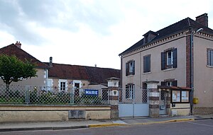
 Town hall (Mairie) of Champlay |
||
Champlay is a French commune in the Yonne department ( Region Bourgogne Franche-Comté ) in Arrondissement Sens and in the canton of Joigny . The municipality has 721 inhabitants (as of January 1, 2017), who are called Campolaïciens or Champlaisiens .
geography
Champlay is located about 19 kilometers north-northwest of Auxerre on the Yonne river , which borders the municipality to the north, and on its tributary Ravillon . Champlay is surrounded by the neighboring communities of Joigny in the north and northwest, Laroche-Saint-Cydroine in the northeast, Épineau-les-Voves in the east, Valravillon in the south, Senan in the southwest, Montholon in the west and southwest and Paroy-sur-Tholon in the west and Northwest.
Population development
| year | 1962 | 1968 | 1975 | 1982 | 1990 | 1999 | 2006 | 2013 |
|---|---|---|---|---|---|---|---|---|
| Residents | 578 | 536 | 556 | 637 | 675 | 628 | 659 | 722 |
| Source: Cassini and INSEE | ||||||||
Attractions
- Saint Martin Church
Personalities
- Louis Vasserot (1771–1840), division general
Web links
Commons : Champlay - collection of images, videos and audio files

