
Dordogne (river)
|
Dordogne Dordonha |
||
 The main rivers of France, including the Dordogne |
||
| Data | ||
| Water code | FR : P --- 0000 | |
| location | Southwest France | |
| River system | Dordogne | |
| Drain over | Gironde → Atlantic Ocean | |
| source | at Puy de Sancy , in the municipality of Mont-Dore 45 ° 32 ′ 17 ″ N , 2 ° 49 ′ 8 ″ E |
|
| Source height | 1366 m | |
| Confluence with the Garonne | near Bordeaux and formation of the Gironde estuary Coordinates: 45 ° 2 ′ 42 ″ N , 0 ° 36 ′ 22 ″ W 45 ° 2 ′ 42 ″ N , 0 ° 36 ′ 22 ″ W |
|
| Mouth height | 3 m | |
| Height difference | 1363 m | |
| Bottom slope | 2.8 ‰ | |
| length | 483 km | |
| Catchment area | 23,957 km² | |
| Medium-sized cities | Bergerac , Libourne | |
| Navigable | in the lower reaches | |
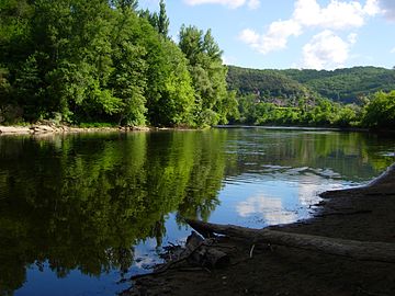
 The Dordogne at Cénac-et-Saint-Julien |
||
The Dordogne [ dɔʀˈdɔɲ ] ( Occitan Dordonha ) is a river in southwestern France . It arises in the municipality of Mont-Dore , near the Puy de Sancy , from the confluence of the source streams Dore and Dogne . It generally drains in a westerly direction, meets the Garonne after a river course of 483 kilometers near the Bec d'Ambès , near Bordeaux , and thus forms a confluence that finally flows into the Atlantic Ocean under the name Gironde . On July 11, 2012, the entire catchment area of the Dordogne was classified as a biosphere reserve by UNESCO .
etymology
The name Dordogne comes from the Celtic name du unna and means fast water . With the occupation of Gaul by the Roman Empire , it was given the name Duranius , from which Duranna , Durunia , Durdunia and finally Dordoigne developed over the course of the Middle Ages . The current name Dordogne gave the Dore and Dogne source rivers, not the other way around.
geography
Crossed departments
The Dordogne crosses the following departments on its way:
- Puy-de-Dôme (63) and
- Cantal (15), both Auvergne-Rhône-Alpes region
- Corrèze (19), in the Nouvelle-Aquitaine region
- Lot (46), in the Occitania region
- Dordogne (24) and
- Gironde (33), both in the Nouvelle-Aquitaine region .
The Dordogne department is named after the river.
Communities on the river
- In the Puy-de-Dôme department:
- Mont-Dore , La Bourboule , Saint-Sauves-d'Auvergne , Avèze , Singles , Larodde , Labessette .
- In the Cantal department:
- Beaulieu , Lanobre , Madic , Saint-Pierre , Champagnac , Veyrières , Arches , Chalvignac .
- In the Corrèze department:
- In the Lot department:
- In the Dordogne department:
- Carlux , Domme , La Roque-Gageac , Beynac-et-Cazenac , Saint-Cyprien , Le Buisson-de-Cadouin , Limeuil , Mauzac-et-Grand-Castang , Lalinde , Mouleydier , Creysse , Bergerac , Prigonrieux , Gardonne .
- In the Gironde department:
Hydrology
The river drains an area of around 24,000 km², its mean flow is 450 m³ / s. At the height of the famous La Roque-Gageac, the river pumps a water volume of 20 m³ / s in the dry season of summer and up to 2500 m³ / s in spring water, which is why the row of houses on the village promenade on the ground floor, which is very popular in France, is uninhabited. Despite costly efforts to regulate the water level of the river through dams and natural or artificial weirs , heavy floods occur in the Dordogne valley , particularly in August, with sometimes severe damage.
Tributaries

|
Left tributaries: |
Right tributaries: |

Shipping today
For professional inland navigation, the Dordogne is navigable from Bergerac, for tourist purposes small sailing ships sail down the river from Domme as nostalgic replicas of historical freighters - the Gabarren ( French: gabares ).
Dams

The course of the Dordogne is interrupted by a total of ten dams / dams. From the source towards the mouth, these are:
- Barrage de La Bourboule
- Barrage de Saint-Sauves-d'Auvergne
- Barrage de Bort-les-Orgues
- Marèges dam
- Dam l'Aigle
- Barrage du Chastang
- Argentat power plant
- Mauzac power station
- Tuilières power station
- Bergerac weir
geology

The two source streams of the Dordogne arise in volcanic rocks of the Monts Dore - predominantly pyroclastic deposits , which are known as cinerites . After their union, the Dordogne first flows north-northeast, before turning west after Mont-Dore. At Saint-Sauves-d'Auvergne it crosses a northeast-trending fault and enters the crystalline basement of the Massif Central . It then reaches the Upper Carboniferous Sillon houiller , which it follows to the south-southwest. At Bort-les-Orgues it leaves the rift fault and then runs through the crystalline rocks of the Variscikums in a south-westerly direction - mica schist , gneiss and granite . The basement is leveled to a pen-leveled hull surface, into which the Dordogne has cut up to 300 meters deep in places. Only after Beaulieu-sur-Dordogne does the river cross from the Massif Central into the Aquitaine Basin - the direction of flow is now to the west, the valley widens and is lined with sedimentary rocks of the Jura as far as Carlux . The Jurassic rocks are predominantly limestone , which tend to form karstified , up to 300 meters thick limestone plateaus (French: causses ). An example of such karstification processes of interest to speleologists and tourists is the Émergence de Meyraguet , a cave-like outlet of an underground river from a steep face of the Dordogne near Lacave . From Carlux to shortly before Bergerac , the Dordogne then crosses the sediments of the Upper Cretaceous - mainly limestone containing fossils and sandy limestone, some of which are yellowish in color. Before Bergerac, the valley widens again to an almost 10 km wide alluvial lowland , which is accompanied by continental, fluvial molasse sediments of the Eocene and Oligocene . These conditions persist up to the confluence with the Garonne.
history
There is evidence that the Dordogne valley has been inhabited since the Iron Age. Archaeological excavations near Bergerac unearthed ancient wine amphorae from the 1st and 2nd centuries BC. BC and thus proved the existence of ancient wine trade routes between Gaul and Ancient Rome , long before viticulture spread throughout France . The use of the river continued into modern times. The use of the Dordogne as an inland waterway was initially opposed to its characteristics as a wild river . It was not until the middle of the 19th century, after the construction of the Canal de Lalinde and numerous locks and weirs, that freight transport on the Dordogne between Argentat and Bordeaux became profitable. Despite the damming, the nature of the river and its seasonal fluctuations in level required a type of boat with a shallow draft and perfect control. These simply constructed gabares were mostly only used to transport goods down the river, were dismantled at the terminal port and sold together with the cargo. The usual cargo of these barges included wood from the upper reaches of the river in the Auvergne, as well as cheese , coal and sweet chestnuts from the Limousin . At the end of the 19th century, commercially used river navigation on the Dordogne completely lost its importance with the development of Europe through rail technology.
Economical meaning
In contrast to neighboring metropolitan areas such as Bordeaux , Limoges or Toulouse , the Dordogne Valley is still predominantly agricultural, poorly developed industrially and is therefore counted as France profonde . The largest economic sector in the Dordogne's area of influence is the food industry. The Périgord region is one of the exquisite French delicacies. In addition, numerous red and white wineries such as Vin de Domme , Pecharmant , Monbazillac , Saint-Émilion and Pomerol have a long tradition in the area around Bergerac , but the Bergeracois vins can hardly assert themselves in the international wine trade due to their direct proximity to the Bordeaux vines.
The Dordogne is today one of the most popular water sports regions and water hiking trails in France due to its picturesque river valley, its village and castle panoramas, which have been well preserved and restored since the Middle Ages, and the shallow river.
Photo gallery
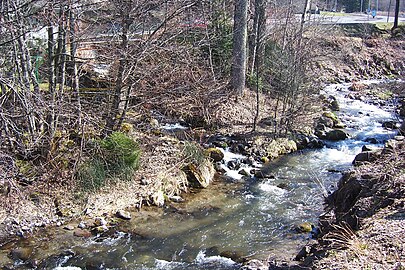
The young Dordogne upstream from Mont-Dore

The Dordogne at the Pont de Chambon in the Cantal department

The river leaves the Massif Central at Beaulieu
The Dordogne crosses the Périgord noir

The Dordogne near Bergerac

The river at Sainte-Foy-la-Grande

The tidal wave on the Dordogne near Saint-Pardon

The Dordogne flows into the Garonne on the Bec d'Ambès


Web links
Individual evidence
- ↑ a b geoportail.fr (1: 16,000)
- ↑ a b c The information on the length of the river is based on the information about the Dordogne from SANDRE (French), accessed on April 22, 2009, rounded to full kilometers.
- ↑ 20 new biosphere reserves. German UNESCO Commission , July 2012, archived from the original on August 14, 2014 ; Retrieved April 20, 2017 .
Camargue (1977) | Commune de Fakarava (1977) | Vallée du Fango (1977) | Cevennes (1984) | Iroise (1988) | Mont Ventoux (1990) | Guadeloupe Archipelago (1992) | Luberon-Lure (1997) | Fontainebleau and Gâtinais (1998) | Northern Vosges (1998) | Dordogne river landscape (2012) | Marais Audomarois (2013) | Monte Viso (2013) | Gardon Caves (2015)