Volders
|
Volders
|
||
|---|---|---|
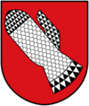
| coat of arms | Austria map | |
|
|
||
| Basic data | ||
| Country: | Austria | |
| State : | Tyrol | |
| Political District : | Innsbruck country | |
| License plate : | IL | |
| Surface: | 32.13 km² | |
| Coordinates : | 47 ° 17 ' N , 11 ° 34' E | |
| Height : | 558 m above sea level A. | |
| Residents : | 4,451 (January 1, 2020) | |
| Postal code : | 6111 | |
| Area code : | 05224 | |
| Community code : | 7 03 65 | |
| NUTS region | AT332 | |
| Address of the municipal administration: |
Bundesstrasse 23 6111 Volders |
|
| Website: | ||
| politics | ||
| Mayor : | Maximilian Harb (Volders parish list) | |
|
Municipal Council : (2016) (17 members) |
||
| Location of Volders in the Innsbruck-Land district | ||
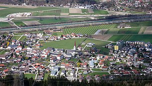
 View from Volderberg to Volders |
||
| Source: Municipal data from Statistics Austria | ||
Volders is a municipality with 4451 inhabitants (as of January 1, 2020) in the Innsbruck-Land district in Tyrol ( Austria ). The municipality is located in the judicial district of Hall in Tirol .
geography
Volders is located in the Inn valley , south of the Inn. The community consists of the settlement in the valley floor and the districts Großvolderberg and Kleinvolderberg in the Voldertal .
The community is only 15 kilometers away from the state capital Innsbruck and has a large proportion of commuters. Volders can be reached via the Inntal motorway A 12, Tiroler Straße B 171 and the Westbahn with the Volders-Baumkirchen stop.
Community structure
The municipality includes the following three localities (population in brackets as of January 1, 2020):
- Grossvolderberg (482)
- Kleinvolderberg (208)
- Volders (3761)
Volders is divided into three cadastral communities : Großvolderberg (2,623.61 ha), Kleinvolderberg (278.58 ha) and Volders (339.36 ha).
In 1973 the formerly independent communities Großvolderberg and Kleinvolderberg were incorporated.
Neighboring communities
| Mils | Baumkirchen | |
| Tulfes |

|
Wattens |
| GPS | Wattenberg |
Parish partnership
There are partnerships with the community of Mühlbach in South Tyrol .
history
Place name
The name Volders probably comes from pre-Roman and thus pre-Christian times. It was written “Volares” between 955 and 1005 and, according to name researcher Karl Finsterwalder, may have pointed to a bend in the road.
Urn field
Between 1955 and 1957, an urn cemetery with 431 graves was discovered in the western part of the Volderer Bachschuttkegel . It comes from the Hallstatt period around 1000-650 BC. This could be determined by C14 examination of charcoal residues that were formed during the cremations. In addition to large ceramics, which served as urns, a large number of grave goods made of bronze, glass, ceramics, ore-containing stone, bones and gold could be found. The grave field covers an area of approx. 2500 m² and is therefore one of the largest closed find complexes in North Tyrol. Today nothing of the graves can be seen at the site, as they were filled in again after the findings were evaluated and are now in the settlement area.
Latène period hilltop settlement "Kingdom of Heaven"
Karl Stainer and later Alfons Kasseroler discovered a hilltop settlement from the younger Iron Age (450 - around the birth of Christ) on the small summit of Himmelreich on the southern edge of the Inn valley . The area has an area of approximately 60 m × 30 m and is 643 m above sea level. Kasseroler's investigations from 1953 onwards brought the discovery of some buildings that were assigned to a homestead. Four larger houses with cellars and superstructures carved into the rock, as well as some outbuildings, a cistern and a 150 m long surrounding wall were exposed. The wall is unlikely to have fulfilled any military tasks. The buildings were all burned down, presumably not due to enemy action, and there were finds from the Middle and Late Latène period in the fire ruins - dishes, weapons and jewelry from the Alpine Fritzens-Sanzeno culture . A coin from the 3rd century BC. BC, a wooden bowl with millet grains and broad beans, as well as a bowl with the inscription chaisurus in the area of the surrounding wall helped with the dating. A burnt offering site was discovered on a terrace in the northwest. The approximately 30 cm thick layer of ash contained bone fragments and stones, the loess soil was burnt hard because of the heat generated. In addition to paving, fibulae , pendants, belt hooks, bronze rings, agricultural and handicraft tools, weapons, Celtic and Roman coins, clay dishes and a Rhaetian lottery stick were discovered. A continued use of the sacrificial site until the Roman Empire is assumed based on the coin finds. Today the Himmelreich open-air museum is located at the site.
middle Ages
Volders appears for the first time in the late 11th century in documents in favor of the Brixen monastery , which was wealthy there. Around 1147/50 the Admont Abbey appears as the owner of real estate in Volders (" Volres "), which was bequeathed to it by a certain Heilica .
Early medieval burial ground
In 2001, a burial ground from the period from the 5th to the 12th and 13th centuries was discovered in the Augasse during construction work. Discovered in the 3rd century AD. At that time it was on the edge of the river terrace of the Inn. Finds such as ceramics, jewelery and coins from the middle Roman Empire and late antiquity already indicate an earlier profane use of the square. 148 burials were uncovered, doubling the number of graves known from this time in Tyrol. Most of the dead belonged to the Romanesque population group, who lived peacefully with the Bavarians who had immigrated at the time (none of the dead showed clear signs of external violence). From the amalgamation of these two population groups in particular, the later Tyroleans emerged. The grave goods come from Romanesque and Bavarian as well as Longobard and Byzantine milieu. This suggests intensive external contacts and a certain wealth.
Modern times
At the beginning of modern times, mostly farmers lived in today's Volders. In 1312 there were around 45 farms, in 1427 there were 79 and at the beginning of the 17th century there were 110, mostly small and medium-sized farmers. This number increased slightly until the 19th century before it began to decrease again in the same century. In addition to agriculture, mining - mostly of silver ores - appeared for shorter episodes, but was never very productive.
In contrast to Groß- and Kleinvolderberg, which until the last century had a strong focus on agriculture, Volders developed early on into a considerable commercial location for a rural community. A blacksmith is attested in Volders as early as 1269. The property tax cadastre from 1775 gives a good overview of the commercial operations in Volders : a brewery, four inns, three blacksmiths (one of which is an arms and nail smithy and a scythe smithy → see Senseler), a sawmill, two mills with an oil press , two grocer's shops (one of them with Brandy trade), a butcher's shop, a baker, a saltpeter factory ( saltpeter was used to make gunpowder ), two tailors, two weavers, two shoemakers, a carpenter and a carpenter.
In the recent past, that is to say in the last two to three decades, the structure of the place developed into that of a suburban municipality due to its proximity to Innsbruck and Hall.
"Senseler"
The Volderer Sensenschmid Anton Reinisch , commonly known as "Senseler", distinguished himself through his bravery as a storm captain in the Battle of Spinges (1797) and gave his name to several clubs, including the Senseler Musikkapelle and the Senseler Schützen .
population
Population development

integration
The state of Tyrol has been running a refugee home on Kleinvolderberg since November 2014. Already at the time of the Kosovo war, the former home for difficult-to-pull boys served as accommodation for refugees and has therefore been specially designated as a refugee home.
politics
The last mayoral elections took place at the same time as the municipal council elections on February 28, 2016.
| Political party | percent | be right | Seats on the local council |
|---|---|---|---|
| Volders parish list - List 1 | 36.76% | 811 | 6th |
| Together for Volders | 30.05% | 663 | 5 |
| Future Volders - Team Schwemberger / Moser | 33.18% | 732 | 6th |
- mayor
- since 2007 Maximilian Harb
Culture and sights
- Friedberg Castle was founded around 1230 by the Counts of Andechs and is located on an elevation above the Inntalboden.
- Aschach Castle was built in 1586 in the form it still has today and is located on a hill near the town center.
- The parish church of St. John the Baptist was first mentioned in 1253, rebuilt in Gothic style from 1437 to 1512 and expanded in the west from 1962 to 1965 according to plans by the architect Clemens Holzmeister .
- The Karlskirche was founded and planned by Hippolyt Guarinoni in 1620 and consecrated in 1654. The first baroque central building in North Tyrol has a peculiar exotic charm.
- The Volders Partisan Association, an association first mentioned in 1854 that accompanies the Holy of Holies in processions, was recognized together with others by UNESCO in 2013 as an intangible cultural heritage in Austria under the name Sacramentsgarden in Tyrol .
Personalities
Sons and daughters of the church
- Matthias Ruef (1745–1822), baroque painter
- Anton Reinisch (1763–1797), scythe smith and freedom fighter
Personalities associated with the community
- Wilfried Stauder (* 1963), tax advisor and politician ( ÖVP )
- Robert Wazinger (* 1966), football player
Web links
- 70365 - Volders. Community data, Statistics Austria .
- Volders in the Hall-Wattens region
Individual evidence
- ↑ Statistics Austria: Population on January 1st, 2020 by locality (area status on January 1st, 2020) , ( CSV )
- ^ Susanne Sievers , Otto Helmut Urban , Peter C. Ramsl: Lexicon for Celtic Archeology. A-K and L-Z ; Announcements of the prehistoric commission in the publishing house of the Austrian Academy of Sciences , Vienna 2012, ISBN 978-3-7001-6765-5 , p. 767.
- ^ Oswald Redlich : The tradition books of the Brixen monastery from the 10th to the 14th century (Acta Tirolensia 1). Wagner: Innsbruck 1899, p. 97, No. 270 (on approx. 1070-1080).
- ↑ Martin Bitschnau , Hannes Obermair : Tiroler Urkundenbuch, II. Department: The documents on the history of the Inn, Eisack and Pustertal valleys. Vol. 2: 1140-1200 . Universitätsverlag Wagner, Innsbruck 2012, ISBN 978-3-7030-0485-8 , p. 51-52 .
- ↑ ao. Univ.-Prof. Dr. Harald Stadler: Media information on the early medieval burial ground of Volders. Retrieved September 11, 2016 .
- ↑ Volders: Volders - a wanted poster. Retrieved September 11, 2016 .
- ^ Local council election 2016 Volders
- ↑ Vice Mayor of Volders


