
Landiswil
| Landiswil | |
|---|---|
 |
|
| State : |
|
| Canton : |
|
| Administrative district : | Bern-Mittelland |
| BFS no. : | 0613 |
| Postal code : | 3434 |
| Coordinates : | 618 351 / 200711 |
| Height : | 764 m above sea level M. |
| Height range : | 684-1039 m above sea level M. |
| Area : | 10.26 km² |
| Residents: | 625 (December 31, 2018) |
| Population density : | 62 inhabitants per km² |
| Website: | www.landiswil.ch |
 Landiswil |
|
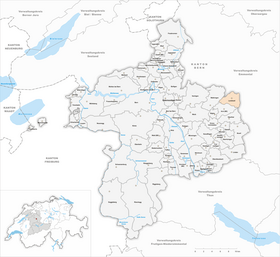
| Location of the municipality | |
  |
|
Landiswil is a municipality in the Bern-Mittelland administrative district in the canton of Bern in Switzerland .
geography
Landiswil lies at 764 m above sea level. M. , 17 km east of the canton capital Bern (linear distance). The farming village extends on a right side stream of the Goldbach, in the molasse heights of the blistering river between the Aare valley in the west and the Emmental in the east.
The area of the 10.3 km² municipal area covers a section of the hill country east of the Aare valley. The entire upper part of the Goldbach catchment area belongs to Landiswil. In contrast to other valleys in the region, the Goldbachtal has a fairly wide, flat valley floor in the area of the municipality. The ridges around Landiswil show a characteristic relief: They are subdivided by numerous short valleys and protruding ridges (so-called harrows). Towards the west, the community spell is separated from the valley and the Bigental by the Aspiegg and the Brandiswald ( 937 m above sea level ). In the south, the municipality extends into the extensive forests of Geissrüggen ( 1031 m above sea level ) and Ätzlischwand (at 1041 m above sea level, the highest elevation in Landiswil) and into the blister forest on the northern roof of the blister river. To the east, the area extends over the ridge of the Ätzlischwand and Sigetel to the adjoining valley, the Nesselgraben . In 1997, 5% of the municipal area was in settlements, 31% in forests and woodlands, 63% in agriculture and a little less than 1% was unproductive land.
The community consists of the two almost equally large settlements Landiswil ( 764 m above sea level ) and Obergoldbach ( 750 m above sea level ). The latter is located in the Goldbachtal and is separated from Landiswil by the Schmittenegg. In addition to the hamlets of Sigetel ( 832 m above sea level ) and Ätzlischwand ( 956 m above sea level ), numerous farm groups and individual farms belong to Landiswil. Neighboring communities of Landiswil are Lützelflüh , Rüderswil , Lauperswil , Oberthal , Arni (BE) and Walkringen .
history
Individual finds from the Neolithic and the Bronze Age indicate an early settlement of the Landiswil area. The first written mention of the place took place in 1277 under the name Landoloswile . Later the names Landeswile (1374), Landiswil (1380) and Langiswil (1550) appeared. The place name probably goes back to the Old High German personal name Landoloh and therefore means at the Landoloh homestead .
Since the Middle Ages , Landiswil has been subordinate to the Emmental district court Ranflüh. In 1399 the village came under the rule of Signau, which was converted into a Bernese bailiwick in 1529; The place of jurisdiction was Konolfingen. After the collapse of the Ancien Régime (1798), Landiswil belonged to the Höchstetten district during the Helvetic period and from 1803 to the Konolfingen district office, which received the status of an official district with the new cantonal constitution of 1831. The Tannentalbad and the Löchlibad were well-attended baths in the first half of the 20th century.
population
With 625 inhabitants (as of December 31, 2018), Landiswil is one of the smaller communities in the canton of Bern. 99.5% of the residents speak German, 0.3% speak Serbo-Croatian and 0.2% speak Spanish (as of 2000). The population of Landiswil was 1021 in 1850, compared to 883 in 1900. In the course of the 20th century, the population continued to decline due to strong emigration.
politics
The voting shares of the parties in the 2015 National Council elections were: SVP 67.7%, BDP 15.4%, GPS 3.7%, SP 3.5%, EDU 2.6%, EVP 2.4%, glp 1.9 %, FDP 1.1%.
economy
Landiswil was a predominantly agricultural village until the second half of the 20th century . Today who have dairy industry , the livestock and agriculture an important role in the employment structure of the population. Further jobs are available in local small businesses and in the service sector, including in companies in the construction industry and wood processing. Some workers are commuters who mainly work in the larger towns in the area.
traffic
The community is far away from the larger thoroughfares on a connecting road from Biglen to Lützelflüh . Landiswil and Obergoldbach are connected to the public transport network through a postbus course , which covers the route from Biglen to Lützelflüh.
Attractions
The reformed village church of Landiswil was built in 1954. In the centers of Landiswil and Obergoldbach there are numerous characteristic farmhouses in the Bernese country style from the 18th and 19th centuries.
Web links
- Official website of the municipality of Landiswil
- Anne-Marie Dubler: Landiswil. In: Historical Lexicon of Switzerland .
Individual evidence
- ↑ Permanent resident population from STAT-TAB of the BfS , municipalities see also regional portraits 2020 on bfs.admin.ch, accessed on May 29, 2020
- ↑ 2015 elections: Results of the Landiswil municipality. Canton of Bern, accessed on March 19, 2016.
Allmendingen | Arni | Bäriswil | Belp | Bern | Biglen | Bolligen | Bowil | Bremgarten near Bern | Brenzikofen | Clavaleyres | Deisswil near Münchenbuchsee | Diemerswil | Ferenbalm | Fraubrunnen | Frauenkappelen | Open-leaved | Gerzensee | Grosshöchstetten | Guggisberg | Gurbrü | Membranous | Herbigen | Iffwil | Ittigen | Jaberg | Jegenstorf | Kaufdorf | Sweep | Gravel | Kirchdorf | Kirchlindach | Köniz | Konolfingen | Kriechenwil | Landiswil | Laupen | Linden | Mattstetten | Meikirch | Mirchel | Moosseedorf | Mühleberg | Münchenbuchsee | Münchenwiler | Münsingen | Muri near Bern | Neuenegg | Niederhünigen | Niedermuhlern | Oberbalm | Oberdiessbach | Oberhünigen | Oberthal | Oppligen | Ostermundigen | Riggisberg | Rubigen | Rüeggisberg | Rümligen | Rüschegg | Schwarzenburg | Stettlen | Thurnen | Toff | Urtenen-Schönbühl | Vechigen | Forest | Walk rings | Wichtrach | Wiggiswil | Wileroltigen | Wohlen near Bern | Worb | Zziwil | Zollikofen | Zuzwil
Former communities: Aeschlen bei Oberdiessbach | Albligen | Ausserbirrmoos | Ball moss | Perch wall | Belpberg | Bleiken near Oberdiessbach | Bremgarten City Court | Bümpliz | Büren to the yard | Englisberg | Etzelkofen | Gelterfingen | Golats | Grafenried | Gysenstein | Hoods | Innerbirrmoos | Church gymnastics | Limpach | Lohnstorf | Mädersforst | Measure barns | Mühledorf | Mill urns | Mülchi | Münchringen | Niederwichtrach | Noflen | Oberscheunen | Oberwichtrach | Otterbach near Oberdiessbach | Rüti near Riggisberg | Shells | Barns | Schlosswil | Schönthal | Stalden in the Emmental | Tägertschi | Trimstone | Electors | Zauggenried | Zimmerwald
Canton of Bern | Administrative districts of the canton of Bern | Municipalities of the Canton of Bern