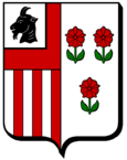
Villers-la-Chèvre
| Villers-la-Chèvre | ||
|---|---|---|

|
|
|
| region | Grand Est | |
| Department | Meurthe-et-Moselle | |
| Arrondissement | Briey | |
| Canton | Mont-Saint-Martin | |
| Community association | Terre Lorraine du Longuyonnais | |
| Coordinates | 49 ° 30 ' N , 5 ° 42' E | |
| height | 312-380 m | |
| surface | 4.02 km 2 | |
| Residents | 568 (January 1, 2017) | |
| Population density | 141 inhabitants / km 2 | |
| Post Code | 54870 | |
| INSEE code | 54574 | |
| Website | http://www.villerslachevre.fr/ | |
 Church of St. Stefan and St. Michael |
||
Villers-la-Chèvre (Luxembourg: Geesswëller ) is a French commune with 568 inhabitants (as of January 1, 2017) in the Meurthe-et-Moselle department in the Grand Est region . It belongs to the Arrondissement of Briey and to the Terre Lorraine du Longuyonnais municipal association founded in 2013 .
geography
The municipality of Villers-la-Chèvre is located near the border triangle France- Belgium - Luxembourg , about six kilometers west-southwest of Longwy . The municipality extends on a little indented plateau north of the deeply cutting Chierstal .
Neighboring communities of Villers-la-Chèvre are Cosnes-et-Romain in the north and east, Cons-la-Grandville in the south, Montigny-sur-Chiers in the south-west and Fresnois-la-Montagne in the west.
history
The name of the place developed from Villers-la-Chièvres 1304 via Villers-la-Chepvre in 1613 to today's Villers-la-Chèvre. It is believed that Chèvre ( = goat ) is a deformation of the river name Chiers , which flows south of the village.
In the 14th century, the Lords of Cons made the village subject to the “Law of Beaumont” ( Loi de Beaumont ), which enabled many places in northeastern France, southern Belgium and Luxembourg to elect their own magistrates.
By marrying Marguerite de Custine, Count Jean de Lambertye became baron in Cons-la-Grandville and in 1641 vassal of the King of France and in 1660 of the Dukes of Lorraine (1660).
During the time of the Ancien Régime , the parish of Villers was part of the deanery in Bazailles , 15 kilometers southeast of Villers-la-Chèvre.
Population development
| year | 1962 | 1968 | 1975 | 1982 | 1990 | 1999 | 2007 | 2017 | |
| Residents | 170 | 179 | 188 | 284 | 389 | 488 | 536 | 568 | |
| Sources: Cassini and INSEE | |||||||||
Attractions
- Parish church of St. Stefan and St. Michael ( Saint-Etienne, Saint-Michel ), originally from the 13th century, rebuilt in 1741 after destruction, new bell tower from 1832 to 1836, sacristy also from the 19th century
- Notre-Dame-de-Bonsecours ( Mariahilf ) chapel from the 19th century, also called Notre-Dame-des Voyageurs
- Lavoir from 1778
partnership
A partnership with the West Irish community of Foxford has existed since 2008 .
Economy and Infrastructure
There are still five farms in the municipality (cereal cultivation, dairy farming). In addition, many residents commute to the nearby industrial parks around Longwy or to Luxembourg .
The main road from Metz to Sedan runs through Villers-la-Chèvre as part of European route 44 from Le Havre to Luxembourg. Other roads connect Villers-la-Chèvre with the surrounding communities. The nearest train station is in Longwy, six kilometers away, with rail connections to Nancy , Luxembourg, Charleville-Mézières , Metz and Thionville .
supporting documents
- ↑ History on villerslachevre.fr. Retrieved April 25, 2011 (French).
- ↑ Villers-la-Chèvre on cassini.ehess.fr
- ↑ Villers-la-Chèvre on insee.fr
- ↑ Jumelages on villerslachevre.fr. (No longer available online.) Formerly in the original ; Retrieved April 25, 2011 (French). ( Page no longer available , search in web archives ) Info: The link was automatically marked as defective. Please check the link according to the instructions and then remove this notice.
- ↑ Farms on annuaire-mairie.fr (French)

