Arveyres
|
Arveyres Arvèiras |
||
|---|---|---|

|
|
|
| region | Nouvelle-Aquitaine | |
| Department | Gironde | |
| Arrondissement | Libourne | |
| Canton | Le Libournais-Fronsadais | |
| Community association | Libournais | |
| Coordinates | 44 ° 53 ′ N , 0 ° 17 ′ W | |
| height | 1-41 m | |
| surface | 17.27 km 2 | |
| Residents | 1,960 (January 1, 2017) | |
| Population density | 113 inhabitants / km 2 | |
| Post Code | 33500 | |
| INSEE code | 33015 | |
| Website | http://www.arveyres.com/ | |
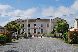
 Town hall (Mairie) of Arveyres |
||
Arveyres ( Occitan Arvèiras ) is a southwestern French community with 1,960 inhabitants (as of January 1 2017) in the department of Gironde in the region Nouvelle-Aquitaine (before 2016 Aquitaine ). The municipality belongs to the Arrondissement of Libourne and the canton of Le Libournais-Fronsadais (until 2015 Libourne ). The inhabitants are called Arveyrois .
geography
Arveyres is located about 26 kilometers east-northeast of Bordeaux on the Dordogne , which borders the municipality in the north, east and north-west. Arveyres is surrounded by the neighboring communities of Fronsac in the north, Libourne in the east, Génissac in the southeast, Cadarsac and Nérigean in the south, Saint-Germain-du-Puch in the southwest and Vayres in the west.
The A89 autoroute runs through the municipality .
Population development
| year | 1962 | 1968 | 1975 | 1982 | 1990 | 1999 | 2006 | 2017 |
| Residents | 1605 | 1726 | 1757 | 1849 | 1819 | 1624 | 1789 | 1960 |
| Sources: Cassini and INSEE | ||||||||
education
In the village is the Collège Jean-Auriac, which has had a school partnership with the Ortenburg high school in Oberviechtach in Bavaria since 2002 . There are regular student exchanges between the two schools .
Attractions
See also: List of Monuments historiques in Arveyres
- Ruins of the Arveyres Commandery
literature
- Le Patrimoine des Communes de la Gironde. Flohic Éditions, Volume 2, Paris 2001, ISBN 2-84234-125-2 , pp. 877-878.

