
Borstel (Holstein)
| coat of arms | Germany map | |
|---|---|---|

|
Coordinates: 53 ° 58 ' N , 9 ° 48' E |
|
| Basic data | ||
| State : | Schleswig-Holstein | |
| Circle : | Segeberg | |
| Office : | Bad Bramstedt-Land | |
| Height : | 13 m above sea level NHN | |
| Area : | 5.12 km 2 | |
| Residents: | 129 (Dec. 31, 2019) | |
| Population density : | 25 inhabitants per km 2 | |
| Postal code : | 24616 | |
| Area code : | 04324 | |
| License plate : | SE | |
| Community key : | 01 0 60 013 | |
| Office administration address: | König-Christian-Strasse 6 24576 Bad Bramstedt |
|
| Website : | ||
| Mayor : | Ulrich Badde (KWV) | |
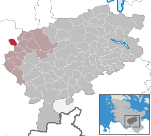
| Location of the Borstel community in the Segeberg district | ||
  |
||

Borstel is a municipality in the Segeberg district in Schleswig-Holstein . It is located in a densely wooded area. It is not to be confused with the 1927 eingemeindeten district Borstel the community Sülfeld in the same circle. Borstel lies on both sides of the Hamburg-Altona-Kiel railway line between Brokstedt in the north, Hagen in the east, Quarnstedt in the south and Störkathen in the west. The community is almost completely surrounded by the Steinburg district .
history
Borstel was first mentioned in a document in 1520. Borstel is made up of “bur” for “home” and “stall” for “place”. The place name could indicate a desert .
politics
Community representation
Since the municipal elections in 2013, the KWV voter community has all seven seats in the municipal council.
coat of arms
Blazon : "In green a golden hill drawn out like a Romanesque arched window , inside a red half-timbered house, including a holly (Ilex aquifolium) with three green leaves and five red fruits."
Partner municipality
Borstel maintains a community partnership with Schlemin in Mecklenburg-Western Pomerania.
economy
The community is predominantly agricultural, but there are also commuters, especially to Itzehoe , Bad Bramstedt and Hamburg .
Well-known Borsteler
- Theodor Rehbenitz (1791–1861), born in Borstel, German painter.
- Karsten Huck (* 1945) won the bronze medal in show jumping at the Olympic Games in Seoul in 1988 .
- Bernhard Achterberg (1945–1998), psychologist.
Web links
Individual evidence
- ↑ North Statistics Office - Population of the municipalities in Schleswig-Holstein 4th quarter 2019 (XLSX file) (update based on the 2011 census) ( help on this ).
- ↑ a b Schleswig-Holstein topography. Vol. 2: Boren - Ellerau . 1st edition Flying-Kiwi-Verl. Junge, Flensburg 2002, ISBN 978-3-926055-68-2 , p. 35 ( dnb.de [accessed June 12, 2020]).
- ↑ Schleswig-Holstein's municipal coat of arms
Alveslohe | Armstedt | Bad Bramstedt | Bad Segeberg | Bahrenhof | Bark | Bebensee | Bimöhlen | Blunk | Boostedt | Bornhöved | Borstel | Bühnsdorf | Daldorf | Damsdorf | Dreggers | Ellerau | Fahrenkrug | Föhrden-Barl | Fredesdorf | Fuhlendorf | Geschendorf | Glasau | Gönnebek | Groß Kummerfeld | Gross Niendorf | Groß Rönnau | Great Aspen | Hagen | Hardebek | Hartenholm | Hasenkrug | Rabbit Moor | Heidmoor | Heidmühlen | Henstedt-Ulzburg | Hitzhusen | Högersdorf | Hüttblek | Itzstedt | Kaltenkirchen | Kattendorf | Kayhude | Kisdorf | Klein Gladebrugge | Klein Rönnau | Krems II | Kükels | Latendorf | Leezen | Lentföhrden | Mönkloh | Mözen | Near | Negro Bay | Take | Neuengörs | Neversdorf | Norderstedt | Use | Oering | Oersdorf | Pronstorf | Rickling | Rohlstorf | Schackendorf | Sheer | Schmalensee | Narrow field | Schwissel | Seedorf | Seth | Sievershütten | Stipsdorf | Stocksee | Strukdorf | Struvenhütten | Stuvenborn | Sülfeld | Tarbek | Tensfeld | Fields of death | Trappenkamp | Travenhorst | Traventhal | Wahlstedt | Wakendorf I | Wakendorf II | Weddelbrook | Weede | Wensin | Westerrade | Wiemersdorf | Winsen | Wittenborn
Non-parish area in the Segeberg
forest district of Buchholz