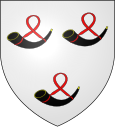
Hardifort
| Hardifort | ||
|---|---|---|

|
|
|
| region | Hauts-de-France | |
| Department | North | |
| Arrondissement | Dunkerque | |
| Canton | Wormhout | |
| Community association | Flandre Intérieure | |
| Coordinates | 50 ° 49 ′ N , 2 ° 29 ′ E | |
| height | 24-130 m | |
| surface | 6.14 km 2 | |
| Residents | 381 (January 1, 2017) | |
| Population density | 62 inhabitants / km 2 | |
| Post Code | 59670 | |
| INSEE code | 59282 | |
Hardifort , Harrevôorde in West Flanders , is a commune in French Flanders in France . It belongs to the Hauts-de-France region , the Nord department , the Dunkerque arrondissement and the Wormhout canton ( canton Cassel until 2015 ). It borders on Wormhout , Oudezeele , Cassel , Wemaers-Cappel and Zermezeele . The residents call themselves Hardifortois .
The former Route nationale 16 leads via Hardifort.
Population development
| year | 1962 | 1968 | 1975 | 1982 | 1990 | 1999 | 2008 | 2013 |
|---|---|---|---|---|---|---|---|---|
| Residents | 395 | 345 | 328 | 338 | 360 | 366 | 384 | 371 |
Mairie Hardifort
See also
literature
- Le Patrimoine des Communes du Nord. Flohic Editions, Volume 1, Paris 2001, ISBN 2-84234-119-8 , pp. 466-467.
Web links
Commons : Hardifort - collection of images, videos and audio files


