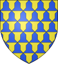
Nieurlet
| Nieurlet | ||
|---|---|---|

|
|
|
| region | Hauts-de-France | |
| Department | North | |
| Arrondissement | Dunkerque | |
| Canton | Wormhout | |
| Community association | Hauts de Flandre | |
| Coordinates | 50 ° 47 ' N , 2 ° 17' E | |
| height | 0-28 m | |
| surface | 10.25 km 2 | |
| Residents | 937 (January 1, 2017) | |
| Population density | 91 inhabitants / km 2 | |
| Post Code | 59143 | |
| INSEE code | 59433 | |
| Website | http://www.herzeele.fr/ | |
 Town Hall (Mairie) by Nieurlet |
||
Nieurlet ( Flemish : Nieuwerleet ) is a French municipality with 937 inhabitants (as of January 1 2017) in Nord in the region of Hauts-de-France . It belongs to the Arrondissement of Dunkerque and the Canton of Wormhout . The inhabitants are called Nieurletois .
geography
Nieurlet is about 28 kilometers south-southwest of Dunkirk . The municipality is part of the Caps et Marais d'Opale Regional Nature Park .
Nieurlet is surrounded by the neighboring communities of Lederzeele in the north, Buysscheure in the east and northeast, Noordpeene in the east, Clairmarais in the south and southeast, Saint-Omer in the south and Saint-Momelin in the west and northwest.
Population development
| year | 1962 | 1968 | 1975 | 1982 | 1990 | 1999 | 2006 | 2013 |
| Residents | 833 | 830 | 822 | 857 | 944 | 934 | 977 | 986 |
| Source: Cassini and INSEE | ||||||||
Attractions
- Church of the Immaculate Conception ( Église d'Immaculée-Conception )
literature
- Le Patrimoine des Communes du Nord. Flohic Editions, Volume 2, Paris 2001, ISBN 2-84234-119-8 , p. 1764.
Web links
Commons : Nieurlet - collection of images, videos and audio files

