Heath (Radevormwald)
|
pagan
City of Radevormwald
Coordinates: 51 ° 11 ′ 32 " N , 7 ° 19 ′ 31" E
|
||
|---|---|---|
| Height : | 320 m above sea level NHN | |
| Residents : | 77 (Nov 15, 2004) | |
| Postal code : | 42477 | |
| Area code : | 02195 | |
|
Location of Heide in Radevormwald |
||
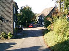
Heide is a place in Radevormwald in the Oberbergischer Kreis in the North Rhine-Westphalian administrative district of Cologne in Germany .
Location and description
The place is on the state road 412 between Heidersteg and Grünenbaum near the Wuppertalsperre . Other neighboring towns are Honsberg and Berg .
West of Heath flows into the Wuppertalsperre opens Heiderbach . A tributary of the Heider Bach, the Heider Siepen Bach, rises in the eastern part of the village.
history
The place was mentioned for the first time in 1487 , namely “Aleff up der Heyden is listed in the conveyance (= loan list) for Duke Wilhelm III. von Berg ”.
Spelling of the first mention: Heyden
Before the closure of the Wuppertal Railway ( timetable KBS 403) between Radevormwald and Wuppertal, Heide had its own stopping point.
politics and society
Politically, the place is represented by the direct candidate of constituency 12 in the city council of Radevormwald.
Bus and train connections
To the public transport Heath is served by the public bus line 3 "Honsberger".
leisure
Hiking and biking trails
The R1 cycle path runs along the old railway line through the village.


