Moriviller
| Moriviller | ||
|---|---|---|

|
|
|
| region | Grand Est | |
| Department | Meurthe-et-Moselle | |
| Arrondissement | Luneville | |
| Canton | Lunéville-2 | |
| Community association | Communauté de communes Meurthe Mortagne Moselle | |
| Coordinates | 48 ° 29 ′ N , 6 ° 27 ′ E | |
| height | 248-344 m | |
| surface | 7.24 km 2 | |
| Residents | 93 (January 1, 2017) | |
| Population density | 13 inhabitants / km 2 | |
| Post Code | 54830 | |
| INSEE code | 54386 | |
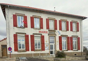
 Mairie Moriviller |
||
Moriviller is a municipality in the French department of Meurthe-et-Moselle in the administrative region of Grand Est . It belongs to the canton of Lunéville-2 and the arrondissement of Lunéville . Neighboring communities are Landécourt in the north-west, Franconville in the north, Gerbéviller in the east, Remenoville in the south-east, Rozelieures in the south and Clayeures in the south-west.
Population development
| year | 1962 | 1968 | 1975 | 1982 | 1990 | 1999 | 2008 | 2015 |
|---|---|---|---|---|---|---|---|---|
| Residents | 136 | 124 | 104 | 107 | 96 | 81 | 90 | 97 |
Web links
Commons : Moriviller - collection of images, videos and audio files


