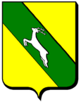
Igney (Meurthe-et-Moselle)
| Igney | ||
|---|---|---|

|
|
|
| region | Grand Est | |
| Department | Meurthe-et-Moselle | |
| Arrondissement | Luneville | |
| Canton | Baccarat | |
| Community association | Vezouze en Piémont | |
| Coordinates | 48 ° 38 ' N , 6 ° 49' E | |
| height | 296-354 m | |
| surface | 4.71 km 2 | |
| Residents | 124 (January 1, 2017) | |
| Population density | 26 inhabitants / km 2 | |
| Post Code | 54450 | |
| INSEE code | 54271 | |
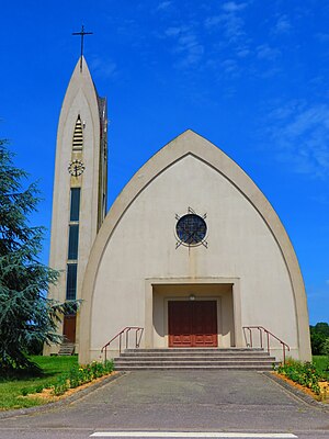
 Saint Martin Church |
||
Igney is a French commune with 124 inhabitants (as of January 1, 2017) in the Meurthe-et-Moselle department in the Grand Est region (until 2015 Lorraine ). It belongs to the Arrondissement of Lunéville .
geography
The municipality of Igney lies on the border with the Moselle department , roughly halfway between Sarrebourg and Lunéville .
history
The place belonged to the neighboring canton of Réchicourt-le-Château until the Franco-Prussian War and was ceded to the German Empire , but France was able to get it back through renegotiations in October 1871.
Because of its proximity to the important border station at Avricourt, Igney had significantly more inhabitants (880 inhabitants at the end of the 19th century).
Population development
| year | 1962 | 1968 | 1975 | 1982 | 1990 | 1999 | 2007 | 2017 |
| Residents | 155 | 168 | 160 | 143 | 141 | 127 | 113 | 124 |
Web links
Commons : Igney - collection of images, videos and audio files
