
Buriville
| Buriville | ||
|---|---|---|

|
|
|
| region | Grand Est | |
| Department | Meurthe-et-Moselle | |
| Arrondissement | Luneville | |
| Canton | Baccarat | |
| Community association | Vezouze en Piémont | |
| Coordinates | 48 ° 32 ' N , 6 ° 43' E | |
| height | 249-326 m | |
| surface | 11.44 km 2 | |
| Residents | 74 (January 1, 2017) | |
| Population density | 6 inhabitants / km 2 | |
| Post Code | 54450 | |
| INSEE code | 54107 | |
_mairie_et_fontaine_B.jpg) Town hall (Mairie) and village fountain |
||

Buriville is a French commune with 74 inhabitants (as of January 1, 2017) in the Meurthe-et-Moselle department in the Grand Est region (before 2016 Lorraine ). It belongs to the Arrondissement of Lunéville and the Canton of Baccarat (until 2015 the Canton of Blâmont ). Its inhabitants call themselves Burivillois (es) .
geography
The municipality is located about 42 kilometers southeast of Nancy in the southeast of the Meurthe-et-Moselle department. The municipality is largely covered by the Bois du Ban de la Rivière forest. Neighboring municipalities are Fréménil in the north, Ogéviller in the northeast and east, Réclonville in the east, Hablainville in the southeast and south, Flin in the south and southwest, Saint-Clément in the west and Bénaménil in the northwest.
history
Today's community is first mentioned in a document in 1111 under the name Burivilla . Buriville was under the Bailiwick of Vic and historically belonged to the province of Trois-Évêchés (Three Dioceses), which in fact fell to France in 1552. Until the French Revolution , the community was then in the Grand-gouvernement de Lorraine-et-Barrois . From 1793 to 1801 the municipality was assigned to the district of Lunéville and the canton of La Neuveville aux Bois. Since 1801 Buriville has also been assigned to the Arrondissement of Lunéville. From 1801 to 2015, the municipality was within the canton of Blâmont and has been part of the canton of Baccarat ever since. Until 1871, the community was in the old Meurt (h) e. Since then it has been part of the Meurthe-et-Moselle department .
Population development
| year | 1793 | 1841 | 1911 | 1921 | 1962 | 1968 | 1975 | 1982 | 1990 | 1999 | 2007 | 2015 |
| Residents | 128 | 191 | 136 | 106 | 57 | 54 | 45 | 44 | 47 | 40 | 65 | 72 |
| Source: Cassini and INSEE | ||||||||||||
traffic
Buriville is close to the railway line from Lunéville to Saint-Dié-des-Vosges. The closest stops are in the neighboring municipality of Azerailles and in Flin (Ménil-Flin). Not far from the municipality, the N59 runs past with a partial connection towards Lunéville in Azerailles and a full connection in Saint-Clément. The D164, which runs through the village, is important for regional traffic.
Attractions
- Saint-Basle village church from the 18th century
- Commemorative plaque for the fallen

Saint-Basle village church
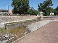
one of the village fountains

Detail of a door portal
_%C3%A9glise_(02).jpg)
_fontaine_A.jpg)
_dessus_de_porte_maison.jpg)