
Laronxes
| Laronxes | ||
|---|---|---|

|
|
|
| region | Grand Est | |
| Department | Meurthe-et-Moselle | |
| Arrondissement | Luneville | |
| Canton | Baccarat | |
| Community association | Territoire de Lunéville à Baccarat | |
| Coordinates | 48 ° 33 ' N , 6 ° 36' E | |
| height | 234-281 m | |
| surface | 6.83 km 2 | |
| Residents | 371 (January 1, 2017) | |
| Population density | 54 inhabitants / km 2 | |
| Post Code | 54950 | |
| INSEE code | 54303 | |
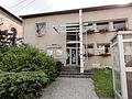
_%C3%A9cole.jpg) Laronxe village school |
||

Laronxe is a French commune with 371 inhabitants (as of January 1, 2017) in the Meurthe-et-Moselle department in the Grand Est region (before 2016 Lorraine ). It belongs to the Arrondissement of Lunéville and the Canton of Baccarat (until 2015 the Canton of Lunéville-Sud ).
geography
The municipality is located about 35 kilometers southeast of Nancy in the south of the Meurthe-et-Moselle department. Neighboring municipalities are Moncel-lès-Lunéville in the north-west, north and north-east, Saint-Clément in the north-east, east, south-east, south and south-west and Fraimbois in the south-west. The community consists of the village of Laronxe and a few hamlets and farmhouses.
history
The present municipality is first mentioned in a document in 1309 as La Ronxe . Laronxe historically belonged to the Duchy of Lorraine , which fell to France in 1766. Until the French Revolution , the community was then in the Grand-gouvernement de Lorraine-et-Barrois . From 1793 to 1801 the community was assigned to the Lunéville district and the canton of Aizerailles. From 1801 to 2015 it was part of the canton of Lunéville-Sud-Est (which became the canton of Lunéville-Sud in 1825). Since 1801 Laronxe is also assigned to the Arrondissement of Lunéville. Until 1871, the community was in the old Meurt (h) e. Since then it has been part of the Meurthe-et-Moselle department . From May 27, 1818 to June 8, 1834 Laronxe was incorporated in Saint-Clément.
Population development
| year | 1793 | 1846 | 1861 | 1962 | 1968 | 1975 | 1982 | 1990 | 1999 | 2007 | 2015 |
| Residents | 309 | 686 | 519 | 454 | 445 | 420 | 428 | 429 | 390 | 373 | 373 |
| Source: Cassini and INSEE | |||||||||||
traffic
Laronxe is located on the railway line from Lunéville to Saint-Dié-des-Vosges, but does not have its own stop. The nearest stop is in the neighboring municipality of Saint-Clément (Saint-Clément-Laronxe train station). The N59 runs through the municipality with a full connection to the western municipality border. The D99, which runs through the village, is important for regional traffic.
Attractions
- 19th century village church of Saint-Sébastien in neo-Romanesque style
- Memorial and plaque for the fallen
- old houses in regional architectural style
- Lavoir (wash house)
- Animal feed factory (former cheese dairy, then canning factory for vegetables)
Town hall (Mairie) of Laronxe

Memorial to the Fallen

Saint-Sébastien village church
Lavoir

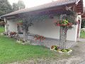
Flower bed on the outskirts
_mairie.jpg)
_monument_aux_morts.jpg)
_%C3%A9glise_(01).jpg)
_lavoir.jpg)
_city_limit_sign.jpg)
Individual evidence
- ↑ Source on the name of the community
- ↑ fixed sights
- ↑ moving sights
- ↑ Memorial to the Fallen
- ↑ Commemorative plaque for the fallen