Mattexey
| Mattexey | ||
|---|---|---|

|
|
|
| region | Grand Est | |
| Department | Meurthe-et-Moselle | |
| Arrondissement | Luneville | |
| Canton | Lunéville-2 | |
| Community association | Meurthe Mortagne Moselle | |
| Coordinates | 48 ° 27 ' N , 6 ° 31' E | |
| height | 270-337 m | |
| surface | 4.97 km 2 | |
| Residents | 67 (January 1, 2017) | |
| Population density | 13 inhabitants / km 2 | |
| Post Code | 54830 | |
| INSEE code | 54356 | |
 Mairie Mattexey |
||
Mattexey is a French commune with 67 inhabitants (as of January 1, 2017) in the Meurthe-et-Moselle department in the Grand Est region . It belongs to the Arrondissement of Lunéville and the Canton of Lunéville-2 .
Neighboring communities are Remenoville and Gerbéviller in the northwest, Seranville in the north, Vallois in the northeast, Magnières in the east, Deinvillers in the southeast, Clézentaine in the south and Giriviller in the southwest.
Population development
| year | 1962 | 1968 | 1975 | 1982 | 1990 | 1999 | 2008 | 2015 |
|---|---|---|---|---|---|---|---|---|
| Residents | 59 | 70 | 49 | 44 | 52 | 65 | 70 | 64 |
Attractions
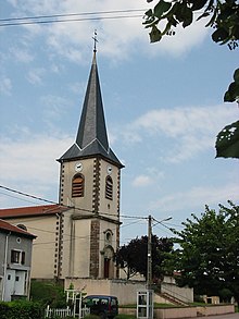
- Saint-Martin church, built in the 18th century, with a 15th century tower
Web links
Commons : Mattexey - collection of images, videos and audio files

