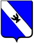
Azerailles
| Azerailles | ||
|---|---|---|

|
|
|
| region | Grand Est | |
| Department | Meurthe-et-Moselle | |
| Arrondissement | Luneville | |
| Canton | Baccarat | |
| Community association | Territoire de Lunéville à Baccarat | |
| Coordinates | 48 ° 29 ′ N , 6 ° 42 ′ E | |
| height | 249-339 m | |
| surface | 14 km 2 | |
| Residents | 771 (January 1, 2017) | |
| Population density | 55 inhabitants / km 2 | |
| Post Code | 54122 | |
| INSEE code | 54038 | |
| Website | http://www.azerailles.fr/ | |
 Town Hall (Mairie) of Azerailles |
||
Azerailles is a French commune with 771 inhabitants (as of January 1, 2017) in the Meurthe-et-Moselle department in the Grand Est region (until 2015: Lorraine ). The municipality belongs to the Arrondissement of Lunéville and the Canton of Baccarat . The inhabitants are called Acervailliens .
geography
Azerailles is located between Lunéville and Saint-Dié at the foot of the Vosges . The Meurthe limits the community in the southwest. Azerailles is surrounded by the neighboring communities of Hablainville in the north and northeast, Brouville in the east, Gélacourt in the east and southeast, Baccarat in the south, Glonville in the south and southwest and Flin in the west.
The National Route 59 runs through the municipality .
history
Population development
| year | 1962 | 1968 | 1975 | 1982 | 1990 | 1999 | 2006 | 2013 |
| Residents | 832 | 846 | 844 | 798 | 792 | 819 | 833 | 800 |
| Source: Cassini and INSEE | ||||||||
Culture and sights
- Saint-Laurent Church, built in 1954
Web links
Commons : Azerailles - Collection of images, videos and audio files

