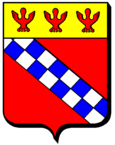
Frémonville
| Frémonville | ||
|---|---|---|

|
|
|
| region | Grand Est | |
| Department | Meurthe-et-Moselle | |
| Arrondissement | Luneville | |
| Canton | Baccarat | |
| Community association | Vezouze en Piémont | |
| Coordinates | 48 ° 36 ' N , 6 ° 53' E | |
| height | 264-364 m | |
| surface | 13.65 km 2 | |
| Residents | 187 (January 1, 2017) | |
| Population density | 14 inhabitants / km 2 | |
| Post Code | 54450 | |
| INSEE code | 54211 | |
Frémonville (1363: Fremetingen ) is a French commune in the Meurthe-et-Moselle department in the Grand Est region (until 2015 Lorraine ).
geography
The municipality of Frémonville is located on the Vezouze on the northwestern edge of the Vosges , about 28 kilometers east of Lunéville . The municipality borders in the north on the Moselle department . Neighboring municipalities of Frémonville are Richeval in the north, Hattigny and Tanconville in the northeast, Cirey-sur-Vezouze in the east, Harbouey in the south, Blâmont in the west and Gogney in the northwest.
Individual evidence
- ↑ Mémoires de la Société d'archéologie Lorraine et du Musée historique Lorrain (1861)
