
Raville-sur-Sânon
| Raville-sur-Sânon | ||
|---|---|---|

|
|
|
| region | Grand Est | |
| Department | Meurthe-et-Moselle | |
| Arrondissement | Luneville | |
| Canton | Lunéville-1 | |
| Community association | Communauté de communes du Pays du Sânon | |
| Coordinates | 48 ° 39 ′ N , 6 ° 30 ′ E | |
| height | 217-274 m | |
| surface | 3.35 km 2 | |
| Residents | 102 (January 1, 2017) | |
| Population density | 30 inhabitants / km 2 | |
| Post Code | 54370 | |
| INSEE code | 54445 | |
_mairie.jpg) Mairie Raville-sur-Sânon |
||

Raville-sur-Sânon is a municipality in France Meurthe-et-Moselle in the Administrative Region Grand Est . It belongs to the arrondissement of Lunéville and the canton of Lunéville-1 . The name affix testifies to the Sânon . Neighboring municipalities are Einville-au-Jard in the northwest, Bauzemont in the northeast, Crion in the southeast, Bienville-la-Petite in the south and Bonviller in the southwest.
Population development
| year | 1962 | 1968 | 1975 | 1982 | 1990 | 1999 | 2008 | 2015 |
|---|---|---|---|---|---|---|---|---|
| Residents | 116 | 124 | 97 | 80 | 92 | 94 | 103 | 103 |
Web links
Commons : Raville-sur-Sânon - Collection of images, videos and audio files
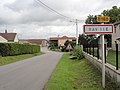
Town entrance

The church in Raville-sur-Sânon

Village fountain
_city_limit_sign.jpg)
_%C3%A9glise_(02).jpg)
_fontaine.jpg)