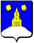
Domptail-en-l'Air
| Domptail-en-l'Air | ||
|---|---|---|

|
|
|
| region | Grand Est | |
| Department | Meurthe-et-Moselle | |
| Arrondissement | Luneville | |
| Canton | Lunéville-2 | |
| Community association | Communauté de communes Meurthe Mortagne Moselle | |
| Coordinates | 48 ° 31 ' N , 6 ° 20' E | |
| height | 249-401 m | |
| surface | 3.13 km 2 | |
| Residents | 71 (January 1, 2017) | |
| Population density | 23 inhabitants / km 2 | |
| Post Code | 54290 | |
| INSEE code | 54170 | |
 Mairie Domptail-en-l'Air |
||
Domptail-en-l'Air is a municipality in France Meurthe-et-Moselle in the region Grand Est . It belongs to the Arrondissement of Lunéville and the Canton of Lunéville-2 . Neighboring municipalities are Haussonville in the northwest, Romain in the northeast, Méhoncourt in the east, Brémoncourt in the southeast, Haigneville in the south, Lorey in the southwest and Saint-Mard in the west.
Population development
| year | 1962 | 1968 | 1975 | 1982 | 1990 | 1999 | 2008 | 2015 |
|---|---|---|---|---|---|---|---|---|
| Residents | 43 | 39 | 32 | 44 | 55 | 51 | 60 | 71 |
Web links
Commons : Domptail-en-l'Air - collection of images, videos and audio files

