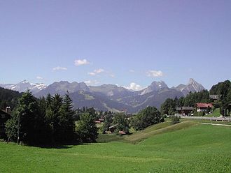
Saanenmöser (pass)
| Saanenmöser | |||
|---|---|---|---|
|
Saanenmöser |
|||
| Compass direction | Northeast | southwest | |
| Pass height | 1279 m above sea level M. | ||
| Canton | Bern | ||
| Valley locations | Zweisimmen | Saanen | |
| expansion | Pass road | ||
| Mountains | Alps | ||
| profile | |||
| Ø pitch | 4.4% (332 m / 7.5 km) | 4.1% (268 m / 6.6 km) | |
| Max. Incline | 7.3% | 6.1% | |
| Map (Bern) | |||
|
|
|||
| Coordinates | 589 530 / 151 253 | ||
Saanenmöser is a Swiss passport in the Saanenland / Canton of Bern and at the same time a district of the municipality of Saanen . Over the pass with an altitude of 1279 m above sea level which leads the main road 11 , the two-Simmen connects and Saanen, and (with a 90 m long summit tunnel) the Montreux-Bernese land track .

