
Saint-Léry
|
Saint-Léry Saent-Leri |
||
|---|---|---|
|
||
| region | Brittany | |
| Department | Morbihan | |
| Arrondissement | Pontivy | |
| Canton | Ploërmel | |
| Community association | Ploërmel Communauté | |
| Coordinates | 48 ° 5 ′ N , 2 ° 15 ′ W | |
| height | 58-89 m | |
| surface | 1.58 km 2 | |
| Residents | 189 (January 1, 2017) | |
| Population density | 120 inhabitants / km 2 | |
| Post Code | 56430 | |
| INSEE code | 56225 | |
_%C3%89glise_07.jpg) Saint-Léry village church |
||

Saint-Léry ( Gallo Saent-Leri , Breton Sant-Leri ) is a commune with 189 inhabitants (at January 1, 2017) in the Morbihan department in the region of Brittany .
geography
Saint-Léry is located around 43 kilometers west of Rennes in the northeast of the Morbihan department. The municipality is on the border of the Morbihan department and the Ille-et-Vilaine department . Neighboring municipalities are Gaël (in the Ille-et-Vilaine department) in the east and Mauron in the south, west and north.
Population development
| year | 1793 | 1821 | 1876 | 1891 | 1962 | 1968 | 1975 | 1982 | 1990 | 1999 | 2006 | 2012 |
|---|---|---|---|---|---|---|---|---|---|---|---|---|
| Residents | 300 | 328 | 246 | 279 | 149 | 136 | 108 | 99 | 161 | 164 | 173 | 189 |
| Sources: Cassini and INSEE | ||||||||||||
language
In the early Middle Ages the area was settled by Bretons and their colloquial language was everyday language. During the second wave of retreat of the Breton language in the late Middle Ages (between 1200 and 1500), the language changed to Gallo . This dialect of French has now almost died out and the population now speaks French.

Town hall (Mairie) of Saint-Léry
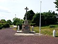
Memorial to the Fallen

Interior view of the village church


Architectural monuments
See: List of Monuments historiques in Saint-Léry
literature
- Le Patrimoine des Communes du Morbihan. Flohic Editions, Volume 2, Paris 1996, ISBN 2-84234-009-4 , pp. 601-603.