
Räcknitz
|
Räcknitz
District of the state capital Dresden
Coordinates: 51 ° 1 ′ 30 ″ N , 13 ° 43 ′ 59 ″ E
|
|
|---|---|
| Height : | 135–205 m above sea level NN |
| Incorporation : | July 1, 1902 |
| Postcodes : | 01069, 01217 |
| Area code : | 0351 |
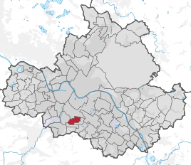  Location of the Räcknitz district in Dresden
|
|
Räcknitz is a district in Dresden in the Plauen district and part of the statistical district Räcknitz / Zschertnitz . It is located south and relatively close to the city center at the beginning of the trunk road to Teplitz , ( Bohemia ), an Ore Mountains pass .
Räcknitz borders on the districts of Plauen , Kleinpestitz , Zschertnitz and Südvorstadt .
history

Räcknitz was first mentioned in 1305 as "Rekenicz" (people of the Rekon). Räcknitz was tied to the city of Dresden very early on through civil goods and was later bought and leased by the Dresden City Council.
The decisive battles of the Battle of Dresden in the Wars of Liberation on August 26th and 27th, 1813, took place in the Räcknitzer corridors. Napoleon's adversary , Jean-Victor Moreau , who fought on the Russian side, was seriously wounded and later died of the injuries. A monument surrounded by three oaks to the southeast above the village center of Räcknitz commemorates him . This consists of a syenite cube on which an iron antique helmet with a laurel wreath and sword rest. The inscription reads: "Moreau the hero fell here at Alexander's side on Aug. 27, 1813". The syenite cube is the remnant of a Germanic sacrificial rock that previously stood near Meissen. The three oaks are intended to commemorate the states of Russia, Prussia and Austria allied against Napoleon.
During the construction of the Tolkewitz waterworks (1896 to 1898), two elevated tanks were built on the Räcknitzhöhe to supply drinking water to the districts on the left bank of the Elbe. In order to secure these facilities, the Volkspark Räcknitz was created in 1898 .
Räcknitz was incorporated into Dresden on July 1, 1902 and joins the suburb ring in the south . With the expansion of trunk road 170, buildings repeatedly had to be demolished. For some years now, the federal road has been leading to the “Dresden-Südvorstadt” motorway junction of Autobahn 17 .
Between 1904 and 1906, a Bismarckian column was built on Franzenshöhe, today at the corner of Moreauweg, Böllstraße and Bulgakowstraße . This structure is only about 50 meters south of the Moreau monument and has been renovated since 2004 and converted into a lookout tower. In August 2008 the Bismarck Tower was inaugurated again with a small festival. Since then there have been regular events such as B. guided star observations instead.
Development

Räcknitz has a preserved village center east of the Bergstrasse , on which the four-lane federal road 170 runs. This trunk road was built in 1846 and replaced the Dresden-Teplitzer Poststrasse , which bypassed the Ore Mountains further east.
The campus of the Technical University of Dresden , which has been expanded near Räcknitz since the end of the 19th century, is partly also in Räcknitz due to its expansion. Not only the university management, but also numerous faculty buildings and the SLUB Dresden with the book museum are located in the Räcknitz district.
The Alte Mensa Dresden is also located in Räcknitz.
Some institute buildings of the Max Planck Society and Leibniz Association were built in the west . In the south of it there is a quarter with loosely built mansions, which was created primarily for the university's teaching staff.
South of the Bismarck Column , a new building area was built in the 1980s, mostly known as the new building area Räcknitzhöhe or the new building area Südhöhe , built from WBS 70/1440 prefabricated buildings . In the center there is a line of sight, which is formed by Ludwig-Renn-Allee and which guides the view of the Bismarck Column directly from the south height. One of the streets in this area bears the name of the Romanist Victor Klemperer , whose diaries from the period 1933–1945, which were first published publicly in the 1990s, made him famous throughout Germany.
See also
literature
- Cornelius Gurlitt : Räcknitz. In: Descriptive representation of the older architectural and art monuments of the Kingdom of Saxony. 24. Issue: Amtshauptmannschaft Dresden-Altstadt (Land) . CC Meinhold, Dresden 1904, p. 113.
Web links
- Räcknitz in the Digital Historical Directory of Saxony
- Räcknitz on dresdner-stadtteile.de
Individual evidence
Districts in districts
Albertstadt |
Outer New Town |
Bubble joke |
Briesnitz |
Bühlau |
Coschütz |
Cotta |
Dobritz |
Dolzschen |
Dresden Heath |
Friedrichstadt |
Grid lake |
Gorbitz |
Gostritz |
Großzschachwitz |
Gruna |
Hellerau |
Hellerberge |
Hosterwitz |
Inner old town |
Inner New Town |
Johannstadt |
Kaditz |
Kaitz |
Kauscha |
Kemnitz |
Small plague |
Kleinzschachwitz |
Klotzsche |
Leaf guest |
Leipzig suburb |
Leuben |
Leubnitz-Neuostra |
Leutewitz |
Lockwitz |
Löbtau |
Loschwitz |
Luga |
Meusslitz |
Mickten |
Mockritz |
Naußlitz |
Nod |
Niederpoyritz |
Niedersedlitz |
Oberpoyritz |
Omsewitz |
Pieschen |
Pillnitz |
Pirnaische Vorstadt |
Plauen |
Prohlis |
Räcknitz |
Radeberger Vorstadt |
Reick |
Rochwitz |
Roßthal |
Seervorstadt |
Seidnitz |
Other |
Sporbitz |
Stetzsch |
Chasing |
Striesen |
Südvorstadt |
Tolkewitz |
Torna |
Trachau |
Trachenberg |
Übigau |
Wachwitz |
White deer |
Wilschdorf |
Wilsdruffer suburb |
Wölfnitz |
Zschertnitz |
Zschieren
Districts in localities
Altfranken |
Alt-Leuteritz |
Borsberg |
Brabuetz |
Cossebaude |
Cunnersdorf |
Eichbusch |
Eschdorf |
Friedersdorf |
Gönnsdorf |
Gohlis |
Gomlitz |
Gompitz |
Helfenberg |
Krieschendorf |
Langebrück |
Lausa |
Malschendorf |
Marsdorf |
Merbitz |
Mob treasure |
Neu-Leuteritz |
Niederwartha |
Oberwartha |
Ocher joke |
Cardboard box |
Pennrich |
Podemus |
Reitzendorf |
Rennersdorf |
Rockau |
Roitzsch |
Rossendorf |
Schönborn |
Schönfeld |
Schullwitz |
Steinbach |
Unkersdorf |
Whitish |
Weixdorf |
Zaschendorf |
Tariff