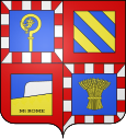
Saint-Sernin-du-Plain
| Saint-Sernin-du-Plain | ||
|---|---|---|

|
|
|
| region | Bourgogne-Franche-Comté | |
| Department | Saône-et-Loire | |
| Arrondissement | Chalon-sur-Saône | |
| Canton | Chagny | |
| Community association | Le Grand Chalon | |
| Coordinates | 46 ° 54 ' N , 4 ° 37' E | |
| height | 230-542 m | |
| surface | 14.45 km 2 | |
| Residents | 581 (January 1, 2017) | |
| Population density | 40 inhabitants / km 2 | |
| Post Code | 71510 | |
| INSEE code | 71480 | |
 Saint Sernin as seen from Mont Rome |
||
Saint-Sernin-du-Plain is a French municipality with 581 inhabitants (at January 1, 2017) in Saône-et-Loire in the Région Bourgogne Franche-Comté .
geography
The municipality is located 17 kilometers northeast of Le Creusot and about 25 kilometers northwest of Chalon-sur-Saône at the foot of Mont Rome .
history
Saint-Sernin was around a parish from the 12th / 13th centuries. Founded Century. The economic focus in the Middle Ages was viticulture and agriculture, in the 19th and 20th centuries also industry, v. a. the mining of iron ore in Mazenay . In 1872 the community had more than 2000 inhabitants.
Population development
| year | 1962 | 1968 | 1975 | 1982 | 1990 | 1999 | 2007 |
| Residents | 762 | 695 | 569 | 550 | 539 | 619 | 612 |
Web links
Commons : Saint-Sernin-du-Plain - Collection of images, videos and audio files
