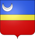
Burnand
| Burnand | ||
|---|---|---|

|
|
|
| region | Bourgogne-Franche-Comté | |
| Department | Saône-et-Loire | |
| Arrondissement | Chalon-sur-Saône | |
| Canton | Cluny | |
| Community association | Entre Saône et Grosne | |
| Coordinates | 46 ° 36 ' N , 4 ° 38' E | |
| height | 219-403 m | |
| surface | 6.52 km 2 | |
| Residents | 129 (January 1, 2017) | |
| Population density | 20 inhabitants / km 2 | |
| Post Code | 71460 | |
| INSEE code | 71067 | |
Burnand is a French municipality with 129 inhabitants (at January 1, 2017) in the department of Saone-et-Loire in the region of Bourgogne Franche-Comté (before 2016 Bourgogne ). The municipality belongs to the arrondissement of Chalon-sur-Saône and the canton of Cluny (until 2015 Saint-Gengoux-le-National ).
geography
Burnand is located about 37 kilometers north-northwest of Mâcon and about 26 kilometers southwest of Chalon-sur-Saône . Neighboring municipalities of Burnand are Saint-Maurice-des-Champs in the north, Saint-Gengoux-le-National in the east and northeast, Savigny-sur-Grosne in the southeast, Curtil-sous-Burnand in the south, and Saint-Clément-sur-Guye in the West and Vaux-en-Pré in the north-west.
Population development
| year | 1962 | 1968 | 1975 | 1982 | 1990 | 1999 | 2006 | 2013 |
| Residents | 174 | 154 | 121 | 113 | 115 | 122 | 113 | 125 |
| Source: Cassini and INSEE | ||||||||
Attractions
- Saint-Nizier church, built between 940 and 980, monument historique since 1994
- Burnand Castle from the 15th century
Web links
Commons : Burnand - collection of images, videos and audio files

