Buchholz (Dithmarschen)
| coat of arms | Germany map | |
|---|---|---|

|
Coordinates: 53 ° 59 ' N , 9 ° 13' E |
|
| Basic data | ||
| State : | Schleswig-Holstein | |
| Circle : | Dithmarschen | |
| Office : | Burg-Sankt Michaelisdonn | |
| Height : | 34 m above sea level NHN | |
| Area : | 14.55 km 2 | |
| Residents: | 998 (Dec. 31, 2019) | |
| Population density : | 69 inhabitants per km 2 | |
| Postal code : | 25712 | |
| Area code : | 04825 | |
| License plate : | HEI, MED | |
| Community key : | 01 0 51 012 | |
| Office administration address: | Holzmarkt 7 25712 Burg |
|
| Website : | ||
| Mayor : | Eggert Braasch (shared flat) | |
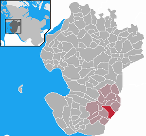
| Location of the municipality of Buchholz in the Dithmarschen district | ||
Buchholz is a municipality in the southeast of the Dithmarschen district in Schleswig-Holstein . In addition to Buchholz, the localities Buchholzermoor and Stubbenberg are also located in the municipality.
geography
location
The community is located on the state road 139 between Kuden and Burg in Dithmarschen .
Neighboring communities
Neighboring communities are the communities of Quickborn , Brickeln and Burg (Dithmarschen) (both in the Dithmarschen district), Ecklak (in the Steinburg district ) and Kuden (in the Dithmarschen district), starting clockwise in the north .
history
On April 1, 1934, the parish of Burg was dissolved. All of their village communities, village communities and farmers became independent communities / rural communities, including Buchholz.
politics
Community representation
Of the eleven seats in the municipal council, the CDU has five seats since the local elections in 2018, and the WG electoral community has six. The SPD stopped running in 2018.
coat of arms
Blazon : “Quartered. 1 and 4 in silver a rooted green deciduous tree, 2 and 3 in green a silver beech leaf. "
The figures of the coat of arms of the municipality of Buchholz show the place name in the picture "talking", whereby the trees express the " wood " in the sense of " forest " and the leaves indicate more precisely which trees the forest preferably consists of, namely red beeches . In terms of the history of its origins, the name goes back to the existence of large-scale deciduous forests that shaped this landscape area before settlement. As it is today, the beech , especially the common beech , was the dominant tree species.
Attractions
traffic
The march line touches the municipality in the north-west; next stop is Burg (Dithm) .
Web links
Individual evidence
- ↑ North Statistics Office - Population of the municipalities in Schleswig-Holstein 4th quarter 2019 (XLSX file) (update based on the 2011 census) ( help on this ).
- ↑ Schleswig-Holstein topography. Vol. 2: Boren - Ellerau . 1st edition Flying-Kiwi-Verl. Junge, Flensburg 2002, ISBN 978-3-926055-68-2 , p. 156 ( dnb.de [accessed June 11, 2020]).
- ↑ State Statistical Office Schleswig-Holstein (Ed.): The population of the communities in Schleswig-Holstein 1867-1970 . State Statistical Office Schleswig-Holstein, Kiel 1972, p. 250 .
- ↑ Schleswig-Holstein's municipal coat of arms


