Hamilton County (Ohio)
 Hamilton County Courthouse |
|
| administration | |
|---|---|
| US state : | Ohio |
| Administrative headquarters : | Cincinnati |
| Address of the administrative headquarters: |
County Courthouse 138 East Court Street Cincinnati, OH 45202-0000 |
| Foundation : | January 2, 1790 |
| Made up from: | Original County |
| Area code : | 001 513 |
| Demographics | |
| Residents : | 802.374 (2010) |
| Population density : | 760.5 inhabitants / km 2 |
| geography | |
| Total area : | 1069 km² |
| Water surface : | 14 km² |
| map | |
| Website : www.hamilton-co.org | |
Hamilton County is a county in the US state of Ohio of the United States . The county seat is Cincinnati .
geography
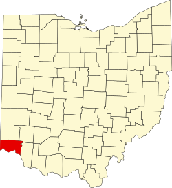
The county is located in the extreme southwest of Ohio, borders Indiana to the west, Kentucky to the south and has an area of 1,069 square kilometers, of which 14 square kilometers are water. It is bordered clockwise by the following counties: Butler County , Warren County , Clermont County , Boone County, Kentucky, Kenton County, Kentucky, Campbell County, Kentucky, and Dearborn County, Indiana.
history
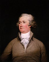
Hamilton County was formed as the original Free Territory County on January 2, 1790. It was named after Alexander Hamilton , a North American politician, statesman, and the first United States Treasury Secretary.
Historical objects
Cincinnati
- 1326 on Hopple Street is the historic Eighteenth District School (also known as Camp Washington Public School ). The building was included as a memorial in the NRHP in 1980 (NRHP 80003051).
- In the Cincinnati area stands the historically covered Jediah Hill Covered Bridge . The road bridge, built in 1850, is located about seven miles north of the Cincinnati metropolitan area off US Route 127 on Covered Bridge Road . The wooden bridge was listed on March 28, 1973 by the National Register of Historic Places as a Historic Monument with the number 73001460.
- In Cincinnati, at 3023-3025 Madison Road , is the historic Twentieth Century Theater .
- The William Howard Taft National Historic Site is located at 2038 on Auburn Avenue . The National Historic Site now functions as a park and museum.
A total of 15 places in the county have the status of a National Historic Landmark . 350 buildings and sites in the county are on the National Register of Historic Places (as of April 5, 2018).
Demographic data
| growth of population | |||
|---|---|---|---|
| Census | Residents | ± in% | |
| 1800 | 15,692 | - | |
| 1810 | 15,258 | -2.8% | |
| 1820 | 31,764 | 108.2% | |
| 1830 | 52,317 | 64.7% | |
| 1840 | 80.145 | 53.2% | |
| 1850 | 156,844 | 95.7% | |
| 1860 | 216.410 | 38% | |
| 1870 | 260,370 | 20.3% | |
| 1880 | 313,374 | 20.4% | |
| 1890 | 374.573 | 19.5% | |
| 1900 | 409.479 | 9.3% | |
| 1910 | 460.732 | 12.5% | |
| 1920 | 493,678 | 7.2% | |
| 1930 | 589.356 | 19.4% | |
| 1940 | 621.987 | 5.5% | |
| 1950 | 723,952 | 16.4% | |
| 1960 | 864.121 | 19.4% | |
| 1970 | 924.018 | 6.9% | |
| 1980 | 873.224 | -5.5% | |
| 1990 | 866.228 | -0.8% | |
| 2000 | 845.303 | -2.4% | |
| 2010 | 802.374 | -5.1% | |
| Before 1900
1900–1990 2000 2010 |
|||
According to the 2000 census , Hamilton County had 845,303 people in 346,790 households and 212,582 families. The population density was 801 inhabitants per square kilometer. The racial the population was composed of 72.93 percent white, 23.43 percent African American, 0.18 percent Native American, 1.61 percent Asian, 0.03 percent of residents from the Pacific island area and 0.51 percent from other ethnic groups Groups; 1.32 percent were descended from two or more races. Hispanic or Latino of any race was 1.13 percent of the population.
Of the 346,790 households, 30.2 percent had children and young people under the age of 18 living with them. 43.4 percent were married couples living together, 14.3 percent were single mothers, 38.7 percent were non-families, 32.9 percent were single households, and 10.6 percent had people aged 65 years or over. The average household size was 2.38 and the average family size was 3.07.
For the entire county, the population was composed of 25.8 percent of residents under 18 years of age, 9.6 percent between 18 and 24 years of age, 29.7 percent between 25 and 44 years of age, 21.5 percent between 45 and 64 years of age 13.5 percent were 65 years of age or over. The median age was 36 years. For every 100 females there were 91.1 males. For every 100 women aged 18 or over there were statistically 86.8 men.
The median income for a household in the county is $ 40,964 , and the median income for a family is $ 53,449. Males had a median income of $ 39,842 versus $ 28,550 for females. The per capita income was $ 24,053. 8.8 percent of families and 11.8 percent of the population are below the poverty line. Of these, 16.2 percent were children or adolescents under 18 years of age and 8.7 percent were people over 65 years of age.
Individual evidence
- ↑ Hamilton County in the United States Geological Survey's Geographic Names Information System . Retrieved February 22, 2011
- ^ Extract from the National Register of Historic Places . Retrieved March 13, 2011
-
^ William Howard Taft National Historic Site on the National Register Information System. National Park Service , accessed April 6, 2018.
Listing of National Historic Landmarks by State: Ohio . National Park Service , accessed April 6, 2018. - ↑ Listing of National Historic Landmarks by State: Ohio . National Park Service , accessed April 6, 2018.
- ↑ Search mask database in the National Register Information System. National Park Service , accessed April 6, 2018.
- ^ US Census Bureau _ Census of Population and Housing . Retrieved February 17, 2011
- ↑ Extract from Census.gov . Retrieved February 21, 2011
- ↑ Excerpt from factfinder.census.gov.Retrieved February 21, 2011
- ↑ United States Census 2010.Retrieved April 1, 2016
- ↑ Hamilton County, Ohio , 2000 census data sheet at factfinder.census.gov .
Web links
- Hamilton County, Ohio ( English ) In: Geographic Names Information System . United States Geological Survey . Retrieved February 7, 2011.
Coordinates: 39 ° 14 ′ N , 84 ° 34 ′ W


