Ashland County (Ohio)
![Ashland County Courthouse in Ashland, listed in the NRHP with the number 79003786 [1]](https://upload.wikimedia.org/wikipedia/commons/thumb/0/04/Ashland-County-Ohio-Courthouse.jpg/298px-Ashland-County-Ohio-Courthouse.jpg) Ashland County Courthouse in Ashland, listed on the NRHP with number 79003786 |
|
| administration | |
|---|---|
| US state : | Ohio |
| Administrative headquarters : | Ashland |
| Address of the administrative headquarters: |
County Courthouse 110 Cottage Street Ashland, OH 44805-2114 |
| Foundation : | February 24, 1846 |
| Made up from: |
Huron County Lorain County Richland County Wayne County |
| Area code : | 001 419 |
| Demographics | |
| Residents : | 53,139 (2010) |
| Population density : | 48.3 inhabitants / km 2 |
| geography | |
| Total area : | 1106 km² |
| Water surface : | 6 km² |
| map | |
| Website : www.ashlandcounty.org | |
Ashland County is a county in the state of Ohio in the United States . The county seat is Ashland .
geography
The county is located in north-central Ohio, around 60 km south of Lake Erie , the southernmost of the 5 Great Lakes , and has an area of 1106 square kilometers, of which six square kilometers are water. It is bordered clockwise by the counties: Lorain County , Medina County , Wayne County , Holmes County , Knox County , Richland County, and Huron County .
history
Ashland County was formed on February 24, 1846 from parts of Huron, Lorain, Richland and Wayne Counties. It was named, as well as the district capital, after the close Lexington located country estate of Henry Clay , a senator from Kentucky .
17 buildings and sites in the county are listed on the National Register of Historic Places (as of April 6, 2018).
Land use
To the north, a watershed of continental importance runs through Ashland County. Here and in the middle the relief is hilly, criss-crossed by erosion channels and many smaller watercourses. Most of the land use is agricultural, but there are also expanding settlements such as the city of Ashland (Ohio) and a few other places. This is traversed by a broad floodplain area running diagonally from northwest to southeast with a number of watercourses.
Further south there is a transition zone from the agricultural north to the wooded south of the county. This zone is made up of agricultural areas, natural areas and local recreation areas and is sparsely populated overall.
Around 23 percent of Ashland County is covered with forest, most of which is in the south (Hanover Township).
Watershed
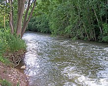
The important continental divide between the water system of the Great Lakes and St. Lawrence in the north and the Mississippi river system, which drains in generally southerly directions via the Muskingum and Ohio Rivers . Across the Mohican River , most of the county is part of the Ohio's drainage system. Only the extreme north belongs to the drainage system of the great lakes.
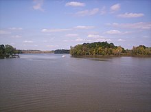
A number of lakes, mostly formed as a result of the last ice age, characterize the image of Ohio. Ashland County has a number of such bodies of water that are of significant ecological and tourist value.
Demographic data
| growth of population | |||
|---|---|---|---|
| Census | Residents | ± in% | |
| 1850 | 23,813 | - | |
| 1860 | 22,951 | -3.6% | |
| 1870 | 21,933 | -4.4% | |
| 1880 | 23,883 | 8.9% | |
| 1890 | 22,223 | -7% | |
| 1900 | 21,184 | -4.7% | |
| 1910 | 22,975 | 8.5% | |
| 1920 | 24,627 | 7.2% | |
| 1930 | 26,867 | 9.1% | |
| 1940 | 29,785 | 10.9% | |
| 1950 | 33,040 | 10.9% | |
| 1960 | 38,771 | 17.3% | |
| 1970 | 43,303 | 11.7% | |
| 1980 | 46.178 | 6.6% | |
| 1990 | 47.507 | 2.9% | |
| 2000 | 52,523 | 10.6% | |
| 2010 | 53,139 | 1.2% | |
| Before 1900
1900–1990 2000 2010 |
|||
According to the 2000 census , Ashland County had 52,523 people in 19,524 households and 14,018 families. The population density was 48 inhabitants per square kilometer. The racial the population was composed of 97.54 percent white, 0.81 percent African American, 0.11 percent Native American, 0.55 percent Asian, 0.03 percent of residents from the Pacific island area and 0.21 percent from other ethnic groups Groups; 0.76 percent were descended from two or more races. Hispanic or Latino of any race was 0.65 percent of the population.
Of the 19,524 households, 32.5 percent had children and young people under the age of 18 living with them. 59.5 percent were married couples living together, 8.5 percent were single mothers, 28.2 percent were non-families, 24.0 percent were single households, and 10.3 percent had people aged 65 years or over. The average household size was 2.58 and the average family size was 3.06.
For the entire county, the population was composed of 25.7 percent of residents under the age of 18, 10.8 percent between 18 and 24 years of age, 26.5 percent between 25 and 44 years of age, and 23.0 percent between 45 and 64 years of age 13.9 percent were 65 years of age or over. The median age was 36 years. For every 100 females there were 96.6 males. For every 100 women aged 18 or over there were statistically 92.4 men.
The median income for a household in the county is $ 39,179 , and the median income for a family is $ 46,306. Males had a median income of $ 32,585 versus $ 22,334 for females. The per capita income was $ 17,308. 7.1 percent of families and 9.5 percent of the population were below the poverty line. Of these, 13.1 percent were children or adolescents under 18 years and 7.5 percent were people over 65 years of age.
Places in Ashland County
city
With the city of Ashland, there is only an urban settlement in Ashland County. Incidentally, the area is more rural.
Municipalities
The following municipalities are in Adams County:
Townships
traffic
The Ashland County Airport
With the Ashland County Airport , the county has a connection to air traffic to regional and national air traffic. The airport has two runways, one in north-south and one in east-west, each 1067 x 23 m.
The number of aircraft movements at the airfield averaged 135 per day in 2006/2007. Most of these are takeoffs and landings of sport and small aircraft.
Streets
The Interstate 71 , a major axis connecting the centers of Cleveland , Columbus and Cincinnati runs from northeast to southwest through Ashland County. The city of Ashland is also served by Interstate 71. In addition, the county is crossed by a number of other roads of regional and national importance. A gradual expansion of the infrastructure is constantly being promoted.
Railways
Three railway lines connect Ashland county with surrounding regions:
- The CSX Transportation line crosses Ashland County in an east-west direction through the northern townships.
- The line of the CIC Railroad , also known as the Ashland Railroad , crosses Ashland County diagonally and connects the main town (county seat) Ashland (Ohio) to the railway network. This railway line is owned by the local Community Improvement Corporation .
- The third line is a stretch of the Norfolk Southern Railway through Loudonville and Perrysville in the south of the county.
economy
Ashland County's economy is generally modern. The agriculture employs only a small part of the workforce and is highly mechanized and mechanized. The service sector has overtaken the manufacturing industry as the most important industrial sector and employs more people than the manufacturing industry. Commercial services ( service industries ) are clearly more important compared to public services.
Agriculture
Ashland County, apart from the city of Ashland, is largely rural. However, the added value and the number of employees are of much less importance than in the manufacturing and service sectors.
Industry, manufacturing
In 1997, 98 manufacturing establishments produced goods valued at $ 1,757,517,000. Salaries totaling $ 215,730 were paid to 7,135 blue-collar workers. The most important industries are plastics processing (8 companies), mechanical engineering (13) and the paper industry (6).
Services
The service sector is the largest economic sector in Ashland County. The trade shows most of the businesses; Retail (183 businesses) and wholesale (47) are important employers, employing around 2,500 people apart from traders and having a combined turnover of over 430 million US dollars in 1997.
In addition, the food service sector with 102 companies and 1,440 employees also plays an important role. In 1997, 40.7 million US dollars were sold here.
In 1997, social and medical services employed 851 people in 83 companies. With annual sales of $ 37.5 million, labor costs account for about half ($ 18.6 million).
The real estate sector and high quality academic and technical services are also of significant importance in Ashland County.
No detailed information can be given about financial and insurance services or the public sector. In 1997, Ohio employed over a quarter of a million employees.
Individual evidence
- ^ Extract from the National Register of Historic Places . Retrieved March 13, 2011
- ^ Ashland County in the United States Geological Survey's Geographic Names Information System . Retrieved February 22, 2011
- ↑ Charles Curry Aiken, Joseph Nathan Kane: The American Counties: Origins of County Names, Dates of Creation, Area, and Population Data, 1950-2010 . 6th edition. Scarecrow Press, Lanham 2013, ISBN 978-0-8108-8762-6 , p. 11 .
- ↑ Search mask database in the National Register Information System. National Park Service , accessed April 6, 2018.
- ↑ a b c cf. Map of land use in Ashland County ( Memento of the original from December 25, 2010 in the Internet Archive ) Info: The archive link has been automatically inserted and has not yet been checked. Please check the original and archive link according to the instructions and then remove this notice.
- ^ US Census Bureau _ Census of Population and Housing . Retrieved February 17, 2011
- ↑ Extract from Census.gov . Retrieved February 21, 2011
- ↑ Excerpt from factfinder.census.gov.Retrieved February 21, 2011
- ↑ United States Census 2010.Retrieved March 30, 2016
- ^ Ashland County, Ohio , 2000 census data sheet at factfinder.census.gov .
- ↑ cf. Ashland County Airport .
- ↑ cf. Ashland County Comprehensive Plan ( page no longer available , search in web archives ) Info: The link was automatically marked as broken. Please check the link according to the instructions and then remove this notice. .
- ↑ cf. 1997 Economic Census ( Memento of the original from July 24, 2008 in the Internet Archive ) Info: The archive link was inserted automatically and has not yet been checked. Please check the original and archive link according to the instructions and then remove this notice.
- ↑ cf. 1997 Economic Census, Summary Statistics for Ashland County, OH ( Memento of the original from May 17, 2008 in the Internet Archive ) Info: The archive link was inserted automatically and has not yet been checked. Please check the original and archive link according to the instructions and then remove this notice.
- ↑ cf. 1997 Economic Census, Summary Statistics for Ohio ( Memento of the original dated December 5, 2007 in the Internet Archive ) Info: The archive link was inserted automatically and has not yet been checked. Please check the original and archive link according to the instructions and then remove this notice.
Web links
Coordinates: 40 ° 50 ′ N , 82 ° 16 ′ W


