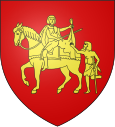
La Boissière (Hérault)
|
La Boissière La Boissièira |
||
|---|---|---|

|
|
|
| region | Occitania | |
| Department | Herault | |
| Arrondissement | Lodève | |
| Canton | Gignac | |
| Community association | Vallée de l'Hérault | |
| Coordinates | 43 ° 40 ′ N , 3 ° 39 ′ E | |
| height | 136-367 m | |
| surface | 24.45 km 2 | |
| Residents | 1,021 (January 1, 2017) | |
| Population density | 42 inhabitants / km 2 | |
| Post Code | 34150 | |
| INSEE code | 34035 | |
| Website | www.laboissiere34.fr | |
 Town hall (Mairie) of La Boissière |
||
La Boissière ( Occitan : La Boissièira ) is a town in the south of France and a municipality with 1,021 inhabitants (as of January 1, 2017) in the Hérault department in the Occitania region (before 2016 Languedoc-Roussillon ). The municipality belongs to the arrondissement of Lodève and the canton of Gignac ( Aniane until 2015 ). The inhabitants are called Bossièrois .
location
La Boissière is located about 40 kilometers northeast of Béziers and about 20 kilometers west-northwest of Montpellier . La Boissière is surrounded by the neighboring communities Puéchabon in the north, Argelliers in the north and northeast, Montarnaud in the east, Saint-Paul-et-Valmalle in the southeast, Aumelas in the south, Gignac in the west and Aniane in the west and northwest.
The A750 autoroute runs along the southern border of the municipality .
Population development
| year | 1962 | 1968 | 1975 | 1982 | 1990 | 1999 | 2006 | 2017 |
|---|---|---|---|---|---|---|---|---|
| Residents | 215 | 221 | 253 | 404 | 594 | 718 | 845 | 1021 |
| Sources: Cassini and INSEE | ||||||||
Attractions
- Saint Martin Church
- Saint-Louis chapel in the Gonzague district
Personalities
- Georges Pézières (1885–1941), politician (SFIO)

