Rouet
|
Rouet Lo Roet |
||
|---|---|---|

|
|
|
| region | Occitania | |
| Department | Herault | |
| Arrondissement | Lodève | |
| Canton | Lodève | |
| Community association | Grand Pic Saint Loup | |
| Coordinates | 43 ° 49 ′ N , 3 ° 49 ′ E | |
| height | 179-500 m | |
| surface | 24.77 km 2 | |
| Residents | 65 (January 1, 2017) | |
| Population density | 3 inhabitants / km 2 | |
| Post Code | 34380 | |
| INSEE code | 34236 | |
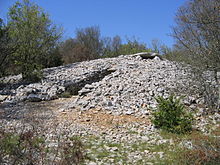
 Rouet - Montagne d'Hortus |
||
Rouet ( Occitan : Lo Roet ) is a place and a municipality with 65 inhabitants (as of January 1, 2017) in the southern French department of Hérault in the Occitanie region .
location
The place Rouet lies at the foot of the southern foothills of the Cevennes ( Montagne d'Hortus ) at an altitude of about 270 meters above sea level. d. M. in the old cultural landscape of the Languedoc . The city of Montpellier is about 39 km (driving distance) in a south-easterly direction; the city of Nîmes is about 60 km to the east.
Population development
| year | 1800 | 1851 | 1901 | 1954 | 1975 | 1999 | 2008 | 2017 |
| Residents | 93 | 138 | 106 | 56 | 49 | 46 | 61 | 65 |
In the 19th century the municipality , which was divided into several hamlets ( hameaux ) and individual farmsteads, always had well over 100 inhabitants. As a result of the phylloxera crisis in viticulture and the increasing mechanization of agriculture , the population fell continuously in the 20th century to the lows of the last decades.
economy
For centuries, the inhabitants of the community lived on agriculture as a self-sufficient source (grain, wine, vegetables, cheese); only the city of Montpellier came into question as a market place for cheese products, salted meat, etc. because of its relative proximity . Viticulture is still important, but since the 1960s tourism has played an increasingly important role in the municipality's economic life in the form of holiday homes ( gîtes ).
history
There are several Neolithic dolmens in the municipality , including the imposing Dolmen du Lamalou . In the 11th or 12th century, the remote Château de la Roquette was built . The place itself had been inhabited since the 12th century at the latest. During the Huguenot Wars (1562-1598), the local church was affected.
Attractions
- The former church of a priory of the Abbey of Maguelone is now the parish church of Saint-Etienne de Gabriac of the parish, surrounded by the cemetery . It is a Romanesque building from the 12th century made of precisely hewn stones . While the semicircular apse is not articulated, the walls of the nave are supported by buttresses . The bell gable ( clocher mur ) above the west facade was built in the 17th century.
- The Dolmen du Lamalou, surrounded on all sides by a cairn, is located about 2.5 km northwest of the town near the source of the Lamalou river ( 43 ° 49 ′ 27 ″ N , 3 ° 47 ′ 59 ″ E ). The complex is one of the most imposing megalithic buildings in the south of France. A few kilometers away are the remains of other dolmens. The complex has been recognized as a monument historique since 1954 .
- The approximately 5.30 m high, but stele-like flattened so-called menhir de Juoilles ( 43 ° 49 '2.6 " N , 3 ° 51' 8.3" O ) should originally have been used as a cover plate of a dolmen, but broke during transport two parts. The two parts were only put together in 1992 and erected not far from where they were found.
- The still impressive ruins on a rock in south-western tip of the community standing Château de la Roquette or Château de Viviourès ( 43 ° 47 '35 " N , 3 ° 49' 8" O ) can only be achieved as part of a several-hour hike. The complex has not been inhabited since the 16th century; it has been classified as a Monument historique since 1940 .
Web links
- Rouet, Viticulture - Info (French)
- Rouet - photo + brief information (French)
- Menhir de Juoilles - Photos
- Rouet, Château - photo + brief information (French)
Individual evidence
- ↑ Dolmen de Lamalou, Rouet in the Base Mérimée of the French Ministry of Culture (French)
- ↑ Restes du château de la Roquette, Rouet in the Base Mérimée of the French Ministry of Culture (French)

