Laroque (Hérault)
| Laroque | ||
|---|---|---|

|
|
|
| region | Occitania | |
| Department | Herault | |
| Arrondissement | Lodève | |
| Canton | Lodève | |
| Community association | Cévennes Gangeoises et Suménoises | |
| Coordinates | 43 ° 55 ' N , 3 ° 44' E | |
| height | 124-490 m | |
| surface | 6.63 km 2 | |
| Residents | 1,624 (January 1, 2017) | |
| Population density | 245 inhabitants / km 2 | |
| Post Code | 34190 | |
| INSEE code | 34128 | |
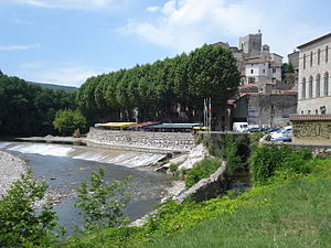
 Dam on the Hérault, church |
||
Laroque ( Occitan : La Ròca) is a French commune in the Hérault department in the Occitanie region . It belongs to the Cévennes Gangeoises et Suménoises municipal association .
On January 1, 2017, the municipality had 1624 inhabitants. They are called "Laroquois".
Laroque is strategically located between Ganges and Saint-Bauzille-de-Putois at the entrance from the Languedoc plain to the Cevennes valleys .
Evidence of settlement in the surrounding caves has been found from prehistoric times. The Phoenicians use the Hérault river to gain access to the Cevennes and the silver and gold mines located there. Celts left menhirs behind, and in the Gallo-Roman times there was an oppidum on the rocky crest . The Prieuré de Saint-Brès was built in Carolingian times, the ruins of which are located one kilometer from the town.
Laroque has a partnership with Saint-Hubert in Belgium.
Population development
| year | 1962 | 1968 | 1975 | 1982 | 1990 | 1999 | 2010 | 2017 |
| Residents | 552 | 535 | 649 | 794 | 1028 | 1126 | 1334 | 1624 |
| Sources: Cassini and INSEE | ||||||||
Individual evidence
- ↑ Laroque-Aynier. ( Memento of the original from December 1, 2006 in the Internet Archive ) Info: The archive link was inserted automatically and has not yet been checked. Please check the original and archive link according to the instructions and then remove this notice.
