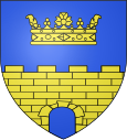
Neuilly-le-Réal
| Neuilly-le-Réal | ||
|---|---|---|

|
|
|
| region | Auvergne-Rhône-Alpes | |
| Department | Allier | |
| Arrondissement | Moulins | |
| Canton | Moulins-2 | |
| Community association | Moulins Community | |
| Coordinates | 46 ° 28 ′ N , 3 ° 26 ′ E | |
| height | 227-293 m | |
| surface | 46.97 km 2 | |
| Residents | 1,456 (January 1, 2017) | |
| Population density | 31 inhabitants / km 2 | |
| Post Code | 03340 | |
| INSEE code | 03197 | |
| Website | http://neuillylereal.planet-allier.com/index.html | |
Neuilly-le-Réal is a French commune with 1,456 inhabitants (at January 1, 2017) in Allier in the region Auvergne Rhône-Alpes ; it belongs to the arrondissement of Moulins and the canton of Moulins-2 . The inhabitants are called Neuillyssois .
geography
Neuilly-le-Réal is about twelve kilometers south-southeast of Moulins . Neuilly-le-Réal is surrounded by the neighboring communities of Toulon-sur-Allier in the north and north-west, Montbeugny in the north and north-east, Chapeau in the east and north-east, Mercy in the east and south-east, Saint-Voir in the south-east, Gouise in the south and Bessay- sur-Allier in the west.
The former route nationale 489 (today's D989) runs through the municipality .
Population development
| year | 1962 | 1968 | 1975 | 1982 | 1990 | 1999 | 2006 | 2013 |
| Residents | 1,254 | 1,205 | 1,084 | 1,201 | 1,287 | 1,303 | 1,343 | 1,458 |
| Source: Cassini and INSEE | ||||||||
Attractions
See also: List of the Monuments historiques in Neuilly-le-Réal
- House of Heinrich IV. From the 16th century
- Lécluse Castle
- Les Gazons house
literature
- Le Patrimoine des Communes de l'Allier. Flohic Editions, Volume 2, Paris 1999, ISBN 2-84234-053-1 , pp. 928-933.

