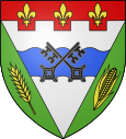
La Ferté-Hauterive
| La Ferté-Hauterive | ||
|---|---|---|

|
|
|
| region | Auvergne-Rhône-Alpes | |
| Department | Allier | |
| Arrondissement | Moulins | |
| Canton | Moulins-2 | |
| Community association | Saint-Pourçain Sioule Limagne | |
| Coordinates | 46 ° 24 ' N , 3 ° 20' E | |
| height | 214-239 m | |
| surface | 18.88 km 2 | |
| Residents | 296 (January 1, 2017) | |
| Population density | 16 inhabitants / km 2 | |
| Post Code | 03340 | |
| INSEE code | 03114 | |
| Website | http://www.la-ferte-hauterive.fr/ | |
La Ferte-Hauterive is a French municipality with 296 inhabitants (as of January 1 2017) in Allier in the region Auvergne Rhône-Alpes ; it belongs to the arrondissement of Moulins and the canton of Moulins-2 .
geography
La Ferté-Hauterive is about 20 kilometers south of Moulins am Allier . La Ferté-Hauterive is surrounded by the neighboring communities of Bessay-sur-Allier in the north and north-east, Saint-Gérand-de-Vaux in the east, Saint-Loup in the south and south-east, Contigny in the south and south-west, Monétay-sur-Allier in the west and south-west and Châtel-de-Neuvre to the west and north-west.
The Route nationale 7 limits the municipality to the east.
The municipality owned a train station on the Moret-Veneux-les-Sablons-Lyon-Perrache railway line, which is no longer used for passenger transport today.
Population development
| year | 1962 | 1968 | 1975 | 1982 | 1990 | 1999 | 2006 | 2011 | 2016 |
| Residents | 434 | 415 | 338 | 355 | 273 | 285 | 270 | 296 | 294 |
| Source: Cassini and INSEE | |||||||||
Attractions
See also: List of Monuments historiques in La Ferté-Hauterive
- Saint-Pierre church from the 18th century
- Priory with donjon, monument historique since 1986
- Les Écherolles castle
literature
- Le Patrimoine des Communes de l'Allier. Flohic Editions, Volume 2, Paris 1999, ISBN 2-84234-053-1 , pp. 920-921.


