
Obernzenn
| coat of arms | Germany map | |
|---|---|---|

|
Coordinates: 49 ° 27 ' N , 10 ° 28' E |
|
| Basic data | ||
| State : | Bavaria | |
| Administrative region : | Middle Franconia | |
| County : | Neustadt an der Aisch-Bad Windsheim | |
| Height : | 376 m above sea level NHN | |
| Area : | 39.67 km 2 | |
| Residents: | 2641 (Dec. 31, 2019) | |
| Population density : | 67 inhabitants per km 2 | |
| Postal code : | 91619 | |
| Area code : | 09844 | |
| License plate : | NEA, SEF, UFF | |
| Community key : | 09 5 75 156 | |
| Market structure: | 17 parts of the community | |
Market administration address : |
Marktplatz 9 91619 Obernzenn |
|
| Website : | ||
| Mayor : | Markus Heindel ( CSU / Country List) | |
| Location of the Obernzenn market in the Neustadt an der Aisch-Bad Windsheim district | ||
  |
||

Obernzenn is a market in the district of Neustadt an der Aisch-Bad Windsheim in Middle Franconia .
geography
Community structure
The municipality has 17 officially named municipal parts (the type of settlement is given in brackets ):
|
|
|
The Schafhof and the Eisen- , Frickleins- , Hölzleins- and Veitsmühle are not officially named parts of the municipality.
Neighboring communities
Neighboring communities are (starting from the north clockwise): Bad Windsheim , Trautskirchen , Flachslanden , Oberdachstetten , Illesheim .
history


Until the 18th century
Obernzenn was probably founded in the 8th century. It was first mentioned by name around 900 as "Cenne", and in 1260 for the first time as "Oberencenne" to differentiate between Unternehmerzenn and Langenzenn. The place name is derived from the river name Zenn . This can be traced back to the Indo-European root * (s) ten (thunder, rustle).
The aristocratic family of the Seckendorff -Aberdar has lived in the village since the 12th century until the end of the 18th century, under which Obernzenn was a sovereign small state of around 40 square kilometers. The place belonged to the Franconian knight circle .
Although the local rule of Seckendorff only became Protestant in 1535, the Obernzenner pastor Philipp Getreu accepted the new church order of the Reformation as early as 1528 during the visit to Ansbach , with the Egenhausen pastor Paul Leutermann in particular being his opponent in implementing the intentions of Margrave Georg . "Superattendens" became true to the Zenndörfer and in 1533 was transferred to Ipsheim.
Christoph Ludwig von Seckendorff-Aberdar began building the baroque Blue Palace , next to which the Red Palace was built from 1745 . The Unterzenn Castle is also owned by Seckendorff.
Towards the end of the 18th century there were 117 properties in Obernzenn. The high court exercised the manor Obernzenn. The village and township government had the box office Neustadt held. The landlords were the manor Obernzenn-Aberdar (41 properties: Blue Castle with dairy, brewery and Meierhof, property yard with office building and economic buildings, 1 inn, 2 courtyards, 1 estate, 1 hereditary forge, 2 Köblersgüter , 23 houses, 1 Jewish school, 1 rock cellar, 1 mill), the manor Obernzenn-Gutend (54 properties: Red Castle, property, 1 inn, 1 administrative building, 12 goods, 1 Häckersgütlein, 37 houses), both manors together (19 properties: church, school, rectory, hospital, bath house , Shepherd's house, Fronveste, spray house and guard house, 12 houses), the Obernzenn parish church (2 houses) and the Jewish community Obernzenn (shepherd's house).At that time the manor Obernzenn belonged to the Barons von Seckendorff and was controlled by the knight canton of Altmühl . It exercised the high court and the village and community rule over Ermetzhof , Straßenhof , Urphertshofen and Wessachhof . It only ruled the village and community over Sontheim . The manor Obernzenn-Gutend was still the landlord in Ermetzhof (15 properties), Lenkersheim (2), Oberdachstetten (3), Sontheim (1 1 ⁄ 2 ), Straßenhof (1), Urphertshofen (18) and Wessachhof (1). The manor Obernzenn-Aberdar was still the landlord in Burgbernheim (5), Charlottenhof (one), Kaubenheim (1), Marktbergel (1), Mitteldachstetten (1), Sontheim (2), Straßenhof (1), Urphertshofen (17) and Weimersheim (1). Both manors together were landlords in Ergersheim (5), Ermetzhofen (5), Oberdachstetten (3), Sontheim (1) and Urphertshofen (4).
In 1806 Obernzenn became part of the new Kingdom of Bavaria . As part of the municipal edict, the Obernzenn tax district was established in 1808 . The rural community formed in 1810 was congruent with the tax district. It was subject to the Leutershausen Regional Court in administration and jurisdiction and to the Colmberg Rent Office for financial administration . The Patrimonial Court Obernzenn-Aberdar had voluntary jurisdiction over 78 families and the Patrimonial Court Obernzenn-Gutend over 88 families. The local police provided both patrimonial courts together. This regulation was valid until 1848. From 1862 on, Obernzenn was administered by the Ansbach District Office and the Ansbach Rent Office. The jurisdiction remained with the district court Leutershausen until 1879. On January 1, 1880, Obernzenn came to the Uffenheim District Office (renamed the Uffenheim District in 1938 ) and the Windsheim Rent Office ( renamed the Windsheim Tax Office in 1920 ). The Windsheim District Court held jurisdiction . In 1961 the municipality had an area of 3,634 km².
Jewish community
From the 17th century there was a Jewish community in Obernzenn. For economic reasons, most Jews left the villages from the middle of the 19th century. The last Jewish inhabitant of Obernzenn died in 1911. The Jewish cemetery is located above the Obernzenner lake and the area of the sports club .
Incorporations
On January 1, 1972, the previously independent municipality of Oberaltenbernheim was incorporated. Urphertshofen was added on January 1, 1974. Egenhausen followed on July 1, 1975. The series of incorporations was completed with the incorporation of Unterzenn on January 1, 1978 and Unteraltenbernheim on May 1, 1978.
Population development
In the period from 1988 to 2018, the population increased from 2,469 to 2,623 by 154 inhabitants or 6.2%.
Obernzenn market
| year | 1987 | 2005 | 2010 | 2011 | 2012 | 2013 | 2014 | 2015 | 2016 | 2017 |
|---|---|---|---|---|---|---|---|---|---|---|
| Residents | 2503 | 2716 | 2663 | 2638 | 2653 | 2635 | 2629 | 2714 | 2665 | 2660 |
| Houses | 640 | 760 | 767 | 773 | 775 | 776 | 780 | 782 | ||
| source |
Part of the municipality Obernzenn
| year | 1818 | 1840 | 1852 | 1855 | 1861 | 1867 | 1871 | 1875 | 1880 | 1885 | 1890 | 1895 | 1900 | 1905 | 1910 | 1919 | 1925 | 1933 | 1939 | 1946 | 1950 | 1952 | 1961 | 1970 | 1987 |
|---|---|---|---|---|---|---|---|---|---|---|---|---|---|---|---|---|---|---|---|---|---|---|---|---|---|
| Residents | 751 | 929 | 929 | 901 | 836 | 901 | 888 | 877 | 891 | 882 | 773 | 752 | 780 | 886 | 925 | 899 | 849 | 887 | 937 | 1134 | 1188 | 1106 | 1058 | 1090 | 1121 |
| Houses | 196 | 161 | 169 | 186 | 178 | 170 | 172 | 192 | 275 | ||||||||||||||||
| source |
politics
Market council
The local elections in 2002, 2008, 2014 and 2020 led to the following allocation of seats in the municipal council:
| 2002 | 2008 | 2014 | 2020 | |
|---|---|---|---|---|
| CSU | 2 | 3 | 3 | 3 |
| SPD / Free Social Citizens | 2 | 1 | - | - |
| List country | 3 | 2 | 3 | 2 |
| Free community of voters | 2 | 3 | 3 | 3 |
| Free citizens | 2 | 2 | 2 | 2 |
| Egenhausen voter community | 2 | 2 | 2 | 2 |
| Urphertshofen citizens' list | 1 | 1 | 1 | 2 |
| total | 14th | 14th | 14th | 14th |
mayor
Mayor Reiner Hufnagel (FWG) has been since 2020. His predecessor was Markus Heindel (CSU - Land list).
badges and flags
The municipality of Obernzenn has had a coat of arms since 1973.
|
|
Blazon : "Under a silver shield head , inside a continuous black bar cross, in red an intertwined silver linden branch , each of which is decorated with four silver leaves."
White and red municipal flag |
| Justification of the coat of arms: The long- standing connection to the Barons von Seckendorff is expressed through the entwined linden branch from their coat of arms. The Balkenkreuz is taken from the coat of arms of the Teutonic Knight Order and indicates the patronage right of the Teutonic Order over the Obernzenner Church. The order was also an important landlord in the municipality. |
Town twinning
Since 1991 the Obernzenn market has maintained a partnership with the community of Markersbach in Saxony . After its merger with the neighboring Raschau , the community partnership with the newly created community Raschau-Markersbach will be continued.
Buildings
From 1978 to 1981 the Obernzenner See was created. It holds 710,000 cubic meters and has an area of 14 hectares. The entire complex with beaches, slipway, riverside paths, beach house, water watch, etc. is 34 hectares in size.
Architectural monuments
Natural monuments
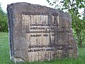
The Fingals Cave is a former sand reed quarry near the village, which served as a hiding place or troop quarters in times of war, was valued as a romantic excursion destination in times of peace and is decorated with numerous inscriptions in different languages.
Sports
In 1922 the gymnastics and sports club (TSV) Obernzenn was founded. The sports practiced were initially only football and sport shooting in the later outsourced shooting department, meanwhile gymnastics, volleyball, athletics and table tennis are also practiced. The association has more than 600 members.
traffic
The state road 2253 runs south to Egenhausen or north to Breitenau over after Ickelheim . The state road 2413 runs east past Unterstzenn to Oberaltenbernheim . District road NEA 39 runs northwest to Sontheim . Communal roads run southwest to Urphertshofen and southeast to Brachbach .
Personalities
- Johann Michael Zeyher (1770–1843), Baden garden director
- Friedrich Karl Rupprecht (1779–1831), painter
- Henriette von Seckendorff-Gutend (1819–1878), Pietist
- Ernst Schneider (1846–1914), German Imperial Judge
- Johann Appler (1892–1978), NSDAP politician, SA and SS man, member of the Reichstag
- Christian Schmidt (* 1957), CSU politician, Federal Minister
- Thorsten Kirschbaum (* 1987), footballer

Coat of arms on the castle

Park view

Egenhausen in winter

Obernzenner See and shore facilities

Water watch at Obernzenner See
Information about the Obernzenner See


literature
- Johann Kaspar Bundschuh : Oberzenn . In: Geographical Statistical-Topographical Lexicon of Franconia . tape 4 : Ni-R . Verlag der Stettinische Buchhandlung, Ulm 1801, DNB 790364301 , OCLC 833753101 , Sp. 236 ( digitized version ).
- Reinhold Hoeppner (ed.): District of Uffenheim . Verl. F. Authorities and Economy Hoeppner, Aßling-Pörsdorf / Obb. 1972, DNB 730115267 , p. 87-88 .
- Hanns Hubert Hofmann : Neustadt-Windsheim (= Historical Atlas of Bavaria, part of Franconia . I, 2). Commission for Bavarian State History, Munich 1953, DNB 452071216 , p. 119 ( digitized version ). Ibid. S. 215 ( digitized version ).
- Hans Karlmann Ramisch: Uffenheim district (= Bavarian art monuments . Volume 22 ). Deutscher Kunstverlag, Munich 1966, DNB 457879262 , p. 157-164 .
- Wolf-Armin von Reitzenstein : Lexicon of Franconian place names. Origin and meaning . Upper Franconia, Middle Franconia, Lower Franconia. CH Beck, Munich 2009, ISBN 978-3-406-59131-0 , p. 169 .
- Pleikard Joseph Stumpf : Oberzenn . In: Bavaria: a geographical-statistical-historical handbook of the kingdom; for the Bavarian people . Second part. Munich 1853, p. 742 ( digitized version ).
Web links
- Obernzenn: Official statistics of the LfStat
- Obernzenn in the Topographia Franconiae of the University of Würzburg , accessed on September 19, 2019.
- Obernzenn in the historical directory of the association for computer genealogy
Individual evidence
- ↑ "Data 2" sheet, Statistical Report A1200C 202041 Population of the municipalities, districts and administrative districts 1st quarter 2020 (population based on the 2011 census) ( help ).
- ^ Obernzenn municipality in the local database of the Bavarian State Library Online . Bayerische Staatsbibliothek, accessed on September 19, 2019.
- ↑ W.-A. v. Reitzstein, p. 169.
- ↑ Secular rule over the village was disputed between the German Order and the Seckendorffs and the church patronage was incumbent on the Spalt monastery .
- ^ Max Döllner : History of the development of the city of Neustadt an der Aisch up to 1933. Ph. CW Schmidt, Neustadt ad Aisch 1950. (New edition 1978 on the occasion of the 150th anniversary of the Ph. CW Schmidt Neustadt an der Aisch 1828–1978. ) P. 193 f .
- ↑ HH Hofmann, p. 119 f.
- ↑ HH Hofmann, p. 69 f.
- ↑ State Archives Nuremberg , Government of Middle Franconia, Chamber of the Interior, 1952, 3863: Formation of the municipal and rural communities in the district court Leutershausen 1810. Quoted from Manfred Jehle: Ansbach: the margravial chief offices of Ansbach, Colmberg-Leutershausen, Windsbach, the Nuremberg nursing office Lichtenau and the Deutschordensamt (Wolframs-) Eschenbach (= Historical Atlas of Bavaria, part of Franconia I, 35). tape 2 . Commission for Bavarian State History, Munich 2009, ISBN 978-3-7696-6856-8 , p. 964 .
- ^ Address and statistical manual for the Rezatkreis in the Kingdom of Baiern . Buchdruckerei Chancellery, Ansbach 1820, p. 55 ( digitized version ).
- ↑ HH Hofmann, p. 215.
- ↑ a b Bavarian State Statistical Office (ed.): Official city directory for Bavaria, territorial status on October 1, 1964 with statistical information from the 1961 census . Issue 260 of the articles on Bavaria's statistics. Munich 1964, DNB 453660959 , Section II, Sp. 830 ( digitized version ).
- ^ Gisela Naomi Blume: The Jewish cemetery Obernzenn 1613–2013 . With a contribution by Michael Schneeberger. Nuremberg 2013 (Free series of publications by the Society for Family Research in Franconia, 24). ISBN 978-3-929865-62-2
- ^ Wilhelm Volkert (ed.): Handbook of Bavarian offices, communities and courts 1799–1980 . CH Beck, Munich 1983, ISBN 3-406-09669-7 , p. 583 .
- ^ Federal Statistical Office (ed.): Historical municipality directory for the Federal Republic of Germany. Name, border and key number changes in municipalities, counties and administrative districts from May 27, 1970 to December 31, 1982 . W. Kohlhammer, Stuttgart / Mainz 1983, ISBN 3-17-003263-1 , p. 722 f .
- ↑ a b Bavarian State Office for Statistics and Data Processing (Ed.): Official local directory for Bavaria, territorial status: May 25, 1987 . Issue 450 of the articles on Bavaria's statistics. Munich November 1991, DNB 94240937X , p. 341 ( digitized version ).
- ↑ a b c d e f g h i Obernzenn: Official statistics of the LfStat
- ↑ Only inhabited houses are given. In 1818 these were designated as fireplaces , in 1840 as houses , and from 1871 to 2017 as residential buildings.
- ↑ Alphabetical index of all the localities contained in the Rezatkkreis according to its constitution by the newest organization: with indication of a. the tax districts, b. Judicial Districts, c. Rent offices in which they are located, then several other statistical notes . Ansbach 1818, p. 68 ( digitized version ).
- ↑ Eduard Vetter (Ed.): Statistical handbook and address book of Middle Franconia in the Kingdom of Bavaria . Self-published, Ansbach 1846, p. 191 ( digitized version ). Obernzenn: 908 inhabitants, 159 houses; Eisenmühle: 10 U, 1 H .; Frickleinsmühle: 11 E., 1 H. According to the historical municipality register , the municipality had 928 inhabitants.
- ↑ a b c d Bavarian State Statistical Office (Hrsg.): Historical municipality register: The population of the municipalities of Bavaria from 1840 to 1952 (= contributions to Statistics Bavaria . Issue 192). Munich 1954, DNB 451478568 , p. 165 , urn : nbn: de: bvb: 12-bsb00066439-3 ( digitized version ).
- ^ Joseph Heyberger, Chr. Schmitt, v. Wachter: Topographical-statistical manual of the Kingdom of Bavaria with an alphabetical local dictionary . In: K. Bayer. Statistical Bureau (Ed.): Bavaria. Regional and folklore of the Kingdom of Bavaria . tape 5 . Literary and artistic establishment of the JG Cotta'schen Buchhandlung, Munich 1867, Sp. 989 , urn : nbn: de: bvb: 12-bsb10374496-4 ( digitized version ).
- ↑ Kgl. Statistical Bureau (ed.): Complete list of localities of the Kingdom of Bavaria. According to districts, administrative districts, court districts and municipalities, including parish, school and post office affiliation ... with an alphabetical general register containing the population according to the results of the census of December 1, 1875 . Adolf Ackermann, Munich 1877, 2nd section (population figures from 1871, cattle figures from 1873), Sp. 1154–1155 , urn : nbn: de: bvb: 12-bsb00052489-4 ( digital copy ). Obernzenn: 875 inhabitants; Iron mill: 12 U .; Frickleinsmühle: 5 E.
- ↑ a b c d e f g h i j Bavarian State Statistical Office (Hrsg.): Historical municipality register: The population of the municipalities of Bavaria in the period from 1840 to 1952 (= contributions to Statistics Bavaria . Issue 192). Munich 1954, DNB 451478568 , p. 186 , urn : nbn: de: bvb: 12-bsb00066439-3 ( digitized version ).
- ↑ K. Bayer. Statistical Bureau (Ed.): Localities directory of the Kingdom of Bavaria. According to government districts, administrative districts, ... then with an alphabetical register of locations, including the property and the responsible administrative district for each location. LIV. Issue of the contributions to the statistics of the Kingdom of Bavaria. Munich 1888, Section III, Sp. 1199 ( digitized version ). Obernzenn: 868 inhabitants, 183 residential buildings; Eisenmühle: 5 E., 2 Wgb .; Frickleinsmühle: 9 E., 1 Wgb.
- ↑ K. Bayer. Statistical Bureau (Ed.): Directory of localities of the Kingdom of Bavaria, with alphabetical register of places . LXV. Issue of the contributions to the statistics of the Kingdom of Bavaria. Munich 1904, Section II, Sp. 1271-1272 ( digitized version ).
- ↑ Bavarian State Statistical Office (ed.): Localities directory for the Free State of Bavaria according to the census of June 16, 1925 and the territorial status of January 1, 1928 . Issue 109 of the articles on Bavaria's statistics. Munich 1928, Section II, Sp. 1309 ( digitized version ).
- ↑ Bavarian State Statistical Office (ed.): Official place directory for Bavaria - edited on the basis of the census of September 13, 1950 . Issue 169 of the articles on Bavaria's statistics. Munich 1952, DNB 453660975 , Section II, Sp. 1134 ( digitized version ).
- ^ Bavarian State Statistical Office (ed.): Official place directory for Bavaria . Issue 335 of the articles on Bavaria's statistics. Munich 1973, DNB 740801384 , p. 176 ( digitized version ).
- ^ Website Obernzenn
- ↑ Local elections 2020 in the Obernzenn market - overview. Retrieved June 17, 2020 .
- ^ Entry on the coat of arms of Obernzenn in the database of the House of Bavarian History
- ↑ Obernzenn. In: Kommunalflaggen.eu. Retrieved June 2, 2020 .

Bad Windsheim | Baudenbach | Burgbernheim | Burghaslach | Dachsbach | Diespeck | Dietersheim | Emskirchen | Ergersheim | Gallmersgarten | Gerhardshofen | Gollhofen | Gutenstetten | Hagenbüchach | Hemmersheim | Illesheim | Ippesheim | Ipsheim | Langenfeld | Marktbergel | Bibart Market | Market Erlbach | Market Nordheim | Market Taschendorf | Münchsteinach | Neuhof an der Zenn | Neustadt an der Aisch | Oberickelsheim | Obernzenn | Oberscheinfeld | Scheinfeld | Simmershofen | Sugenheim | Trautskirchen | Uehlfeld | Uffenheim | Weigenheim | Wilhelmsdorf