
Solaro (Corsica)
| Solaro | ||
|---|---|---|
|
||
| region | Corsica | |
| Department | Upper Corsica | |
| Arrondissement | Corte | |
| Canton | Fiumorbo Castello | |
| Community association | Communauté de communes de Fium'Orbu Castellu | |
| Coordinates | 41 ° 54 ' N , 9 ° 20' E | |
| height | 0-2,018 m | |
| surface | 93.36 km 2 | |
| Residents | 706 (January 1, 2017) | |
| Population density | 8 inhabitants / km 2 | |
| Post Code | 20240 | |
| INSEE code | 2B283 | |
 Solaro |
||

Solaro , in Korean U Sulaghju, is a commune in the French department of Haute-Corse on the Mediterranean island of Corsica . It belongs to the canton of Fiumorbo-Castello in the Arrondissement of Corte . The residents call themselves the Solarais or Sulaghjinchi. The village center lies at 682 meters above sea level. The hamlets of Pielza, Puzzone and Chiola also belong to the municipality .
Geography, infrastructure
Solaro is the southernmost municipality in the Haute-Corse department. It borders in the north on Ventiseri , in the east on the Tyrrhenian Sea , in the south-east on Sari-Solenzara , in the south-west on Quenza , in the west on Zicavo and in the north-west on Chisa . The coastal river Travo forms the border with Sari-Solenzara and thus with the Corse-du-Sud department . There are at least three campsites between the seashore and Route nationale 198 .

Mairie Solaro

Former railway bridge over the Travo coastal river

Solaro church tower
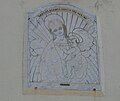
Depiction of Mary with the baby Jesus on the church facade


Population development
| year | 1962 | 1968 | 1975 | 1982 | 1990 | 1999 | 2008 | 2017 |
|---|---|---|---|---|---|---|---|---|
| Residents | 310 | 291 | 309 | 477 | 476 | 583 | 651 | 706 |