
Altenach
| Altenach | ||
|---|---|---|
.svg)
|
|
|
| region | Grand Est | |
| Department | Haut-Rhin | |
| Arrondissement | Altkirch | |
| Canton | Masevaux | |
| Community association | Sud Alsace Largue | |
| Coordinates | 47 ° 36 ' N , 7 ° 7' E | |
| height | 313-386 m | |
| surface | 6.18 km 2 | |
| Residents | 393 (January 1, 2017) | |
| Population density | 64 inhabitants / km 2 | |
| Post Code | 68210 | |
| INSEE code | 68002 | |
 Saint-Sylvestre church |
||

Altenach is a French commune with 393 inhabitants (as of January 1, 2017) in the Haut-Rhin department in the Grand Est region ( Alsace until 2015 ). She is a member of the community association Sud Alsace Largue .
geography
The municipality of Altenach an der Largue is located in the area of the Burgundian Gate in southwest Sundgau , not far from the border with the Territoire de Belfort . Of Altkirch is Altenach about 13, from Belfort about 25 kilometers away.
history
Altenach was first mentioned in 1302 and at that time belonged to the county of Pfirt (Ferrette). The origin of the place name is assumed to be in the name "Alti Ach" ("Old Bach").
From 1871 until the end of the First World War , Altenach belonged to the German Empire as part of the realm of Alsace-Lorraine and was assigned to the Altkirch district in the Upper Alsace district .
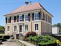
town hall

school

Parish hall

St. Barbara Chapel


Population development
| year | 1910 | 1962 | 1968 | 1975 | 1982 | 1990 | 1999 | 2007 | 2014 |
| Residents | 348 | 229 | 247 | 285 | 306 | 360 | 344 | 387 | 371 |
literature
- Le Patrimoine des Communes du Haut-Rhin. Flohic Editions, Volume 1, Paris 1998, ISBN 2-84234-036-1 , pp. 279-280.