
Gommersdorf (Haut-Rhin)
| Gommersdorf | ||
|---|---|---|
.svg)
|
|
|
| region | Grand Est | |
| Department | Haut-Rhin | |
| Arrondissement | Altkirch | |
| Canton | Masevaux | |
| Community association | Sud Alsace Largue | |
| Coordinates | 47 ° 38 ' N , 7 ° 8' E | |
| height | 287-326 m | |
| surface | 4.15 km 2 | |
| Residents | 361 (January 1, 2017) | |
| Population density | 87 inhabitants / km 2 | |
| Post Code | 68210 | |
| INSEE code | 68107 | |
 Town hall and school building |
||

Gommersdorf is a French commune with 361 inhabitants (as of January 1, 2017) in the Haut-Rhin department in the Grand Est region (until 2015 Alsace ) and is a member of the Sud Alsace Largue community association .
geography
The community of Gommersdorf is located in the Sundgau , about ten kilometers west of Altkirch . The Rhine-Rhône Canal runs in the northwest between the town center and the Largue . Neighboring communities of Gommersdorf are Buethwiller in the north, Hagenbach in the east, Ballersdorf in the southeast, Dannemarie in the south and Wolfersdorf in the west.
history
In 1188 the settlement was called "Gumirsdof". It received its current name in 1581.
Population development
| year | 1962 | 1968 | 1975 | 1982 | 1990 | 1999 | 2007 | 2017 |
| Residents | 271 | 268 | 348 | 344 | 365 | 375 | 366 | 361 |
- Chapel Sainte-Marguerite in Gommersdorf

View from the north 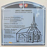
Display board


literature
- Le Patrimoine des Communes du Haut-Rhin. Flohic Editions, Volume 1, Paris 1998, ISBN 2-84234-036-1 , pp. 310-312.
Web links
Commons : Gommersdorf - Collection of images, videos and audio files