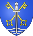
Elbach (Haut-Rhin)
| Elbach | ||
|---|---|---|

|
|
|
| region | Grand Est | |
| Department | Haut-Rhin | |
| Arrondissement | Altkirch | |
| Canton | Masevaux | |
| Community association | Sud Alsace Largue | |
| Coordinates | 47 ° 38 ' N , 7 ° 5' E | |
| height | 309-370 m | |
| surface | 3.18 km 2 | |
| Residents | 259 (January 1, 2017) | |
| Population density | 81 inhabitants / km 2 | |
| Post Code | 68210 | |
| INSEE code | 68079 | |
Elbach ( German Ellbach ) is a French commune with 259 inhabitants (as of January 1, 2017) in the Haut-Rhin department in the Grand Est region (until 2015 Alsace ).
geography
Elbach is in the area of the Burgundian Gate , ten kilometers west of Altkirch and three kilometers west of Dannemarie . The Rhine-Rhône Canal , which overcomes the watershed between the Rhine and the Rhone , runs just under a kilometer south of the town .
The neighboring communities clockwise are Traubach-le-Bas in the north, Wolfersdorf in the east, Retzwiller in the south-east, Valdieu-Lutran in the south-west, Chavannes-sur-l'Étang in the west and Bréchaumont in the north-west.
history
Until the Peace of Westphalia , Elbach belonged to the Thann rule in the Pfirt county .
The chapel was built in 1770 and is dedicated to Saint Pierre and Saint Paul .
From 1871 until the end of the First World War , Elbach belonged to the German Empire as part of the realm of Alsace-Lorraine and was assigned to the Altkirch district in the Upper Alsace district .
Population development
| year | 1910 | 1962 | 1968 | 1975 | 1982 | 1990 | 1999 | 2006 | 2014 |
| Residents | 138 | 138 | 140 | 160 | 243 | 256 | 276 | 270 | 253 |
literature
- Le Patrimoine des Communes du Haut-Rhin. Flohic Editions, Volume 1, Paris 1998, ISBN 2-84234-036-1 , p. 304.
Web links
- Elbach on cc-porte-alsace.fr (French)


