
Arnstein (Lower Franconia)
| coat of arms | Germany map | |
|---|---|---|
.svg)
|
Coordinates: 49 ° 58 ' N , 9 ° 59' E |
|
| Basic data | ||
| State : | Bavaria | |
| Administrative region : | Lower Franconia | |
| County : | Main-Spessart | |
| Height : | 228 m above sea level NHN | |
| Area : | 112.11 km 2 | |
| Residents: | 8116 (Dec. 31, 2019) | |
| Population density : | 72 inhabitants per km 2 | |
| Postal code : | 97450 | |
| Primaries : | 09363, 09360, 09728, 09350 | |
| License plate : | MSP | |
| Community key : | 09 6 77 114 | |
| City structure: | 12 districts | |
City administration address : |
Marktstrasse 37 97450 Arnstein (Lower Franconia) |
|
| Website : | ||
| First Mayor : | Franz-Josef Sauer (CSU) | |
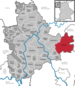
| Location of the town of Arnstein (Lower Franconia) in the Main-Spessart district | ||
  |
||


Arnstein is a town in the Lower Franconian district of Main-Spessart . The only point of intersection between a main latitude and a main longitude in Germany lies in the urban area.
geography
location
The city has a very central geographic location (see also: Intersection Monument and Confluence Point ). The city on the Wern , which cuts through the Main Triangle, is about 20 km from Schweinfurt , 25 km from Würzburg and 9 km (via B 26a ) from the Schweinfurt / Werneck motorway junction . The southern parts of the municipality are already in the Gramschatzer Forest . According to the Bavarian Surveying Administration, the geographical center of Lower Franconia is in the Arnstein district of Büchold .
City structure
Arnstein consists of twelve districts (population figures as of December 31, 2015 in brackets), over which 20 towns are distributed:
|
|
|
Neighboring communities
Surname
The name goes back to an original medieval castle name and consists of the personal name Aro (represented as a bird of prey "Aar" in Arnstein's coat of arms) and the Middle High German word stone (meaning 'rock' or 'rock').
history
Until the church is planted
Originally owned by the Henneberger , Arnstein became a fief of the Rienecker and the Lords of Trimberg . Together with the Trimberg Office and Castle, Arnstein came to the Würzburg Monastery at the end of the 13th century . Arnstein Castle had only been built shortly before and was pledged to the Lords of Hutten at the end of the 13th century . The granting of city rights (city court and fair) took place on November 28, 1333 by Emperor Ludwig of Bavaria .
The von Thüngen and von Hutten families became important for the further development of the city .
The former upper office of the Hochstift Würzburg, which belonged to the Franconian Empire , was secularized in 1803 in favor of Bavaria, came to Archduke Ferdinand of Tuscany in 1805 to form the Grand Duchy of Würzburg , with which it finally fell to the Kingdom of Bavaria in 1814 . In the course of the administrative reforms in Bavaria, today's municipality was created with the municipal edict of 1818 .
History of the Jews in Arnstein
Jews lived in Arnstein in early times . In 1298 the city becomes the scene of a rint meat pogrom . It was not until the middle of the 14th century that Jews returned to the city.
The modern community goes back to an original settlement from the 16th century. Apparently Jews were able to settle again during the Thirty Years' War . It is possible that these fled from rural communities to the city (around 1633/34). In 1675 there are four Jewish families in Arnstein. In 1699 the community consisted of 35 people. By 1740 there were seven Jewish households. Around 1800 there were Jewish residents in the then Arnstein office only in Arnstein itself. The Jewish families all lived in the area of the former "Judengasse" (today Goldgasse), which runs along the city wall from Bettendorfer to Siegersdorfer Tor.
Until the beginning of the 19th century, Jewish families lived almost exclusively from trade. From the middle of the 19th century, some of them opened commercial operations in the city. The community facilities in what was then the "Judengasse" were the synagogue , a Jewish schoolhouse with a religious school and a ritual bath . Dead of the Jewish community were buried in Laudenbach, Euerbach and Schwanfeld.
In 1924 there were 35 Jews in Arnstein. Hermann Holländer gave religious instruction to the then six school-age Jewish children. The community belonged to the Schweinfurt district rabbinate . The chairman of the representative office was Salomon Bauer. The following Jewish associations existed: The Chewra Kadischa (funeral and charity association, among other things to support elderly people passing through, eight members in 1932 under the chairmanship of Salomon Bauer) and the charity association Chewroth (also under the direction of Salomon Bauer; purpose of the association: support, Lectures).
In 1932 there were only three Jewish children of school age. In 1933 there were still 29 Jewish residents, in 1935 32 due to the influx of people. Due to increasing reprisals, 25 of the inhabitants had moved to other places or emigrated abroad by the end of July 1938. In 1935 four people emigrated to Palestine and another four to the United States . The doctor L. Veilchenblau was arrested in 1937 and sentenced to prison in 1939. From this date onwards his trace will be lost. In early 1938, the community was declared dissolved. Immediately after the riots during the November pogrom of 1938, the last two Jewish residents moved, so that from November 1938 onwards, no more Jewish people lived in Arnstein.
The following Jewish residents of Arnstein were killed during the Nazi era:
Berta Aron Freudenberger (* 1880), Paula Bermann (* 1890), Rosalie Dominski (* 1886), Julius Freudenberger (* 1885), Karolina Heymann (* 1875), Rita Holländer (* 1913), Rosa Holländer (* 1878), Selma Hutzler (* 1886), Erna Neuberger (* 1920), Isabella Regensteiner (* 1881), Ida Schloss (* 1913), Johanna Schloss (* 1878), Martha Schulmann (* 1893), Siegfried Siegel (* 1883), Arthur Stein, Fanny Stein (* 1876), Frieda Stein, Herbert S. Stein (* 1935), Ruth Stein (* 1933), Simon Stein (* 1872), Werner L. Stein (* 1932), Toni (Melanie) Strauss ( * 1891), Ludwig Veilchenblau (* 1892).
History of the Arnstein Synagogue

The Arnstein synagogue was built around 1800. It was renovated around 1870 and again in 1934. During the last renovation in 1934, Genesis 28:17 was added as the portal inscription (presumably in Hebrew for "Here is nothing but God's house and here is the gate to heaven"). From 1934, church services were only held for a short time due to the rapidly declining number of members. In April 1938 the synagogue building and the school house were sold.
After 1945 the building came into private ownership and was converted into a residential building. From 1978 it was used as a warehouse. Despite the renovations, the walled up but visible arched windows and the paintings on the ceiling (with state colors and coats of arms) have been preserved.
In the mid-1990s the building was acquired by the city administration. The goal was the repair. In 2005 the support group "Alte Synagoge Arnstein e.V." was founded His goal was to restore the synagogue and transform it into a meeting center. The multi-year renovation work was completed in summer 2012 with an open house. The building is open to the public again.
Incorporations
On January 1, 1972, the previously independent municipality of Binsbach was incorporated. Büchold joined on July 1, 1972. Altbessingen, Binsfeld, Halsheim, Heugrumbach, Müdesheim, Neubessingen and Reuchelheim followed on July 1, 1974. The series of incorporations was completed on May 1, 1978 with the incorporation of Gänheim and Schwebenried.
Population development
In the period from 1988 to 2018, the population increased from 7,723 to 8,125 by 402 inhabitants or 5.2%.
- 1961: 7943 inhabitants
- 1970: 8403 inhabitants
- 1987: 7640 inhabitants
- 1991: 7968 inhabitants
- 1995: 8092 inhabitants
- 2000: 8332 inhabitants
- 2005: 8345 inhabitants
- 2010: 8090 inhabitants
- 2015: 8161 inhabitants
politics
City council
The local elections in 2002, 2008 , 2014 and 2020 resulted in the following allocation of seats in the city council:
| 2002 | 2008 | 2014 | 2020 | |
|---|---|---|---|---|
| CSU | 8th | 9 | 7th | 8th |
| The green | - | - | 2 | 3 |
| SPD | 3 | 2 | 3 | 2 |
| Free learning list | 3 | 4th | 3 | 3 |
| Free voters | 3 | 2 | 3 | 0 |
| Citizens' list of the large municipality of Arnstein | 2 | 1 | - | 2 |
| Young citizens | 1 | 2 | 2 | 2 |
| total | 20th | 20th | 20th | 20th |
mayor
Franz Josef Sauer (CSU) has been mayor since 2019. He prevailed against an opposing candidate with 83.7% of the vote. Anna Stolz (SPD / Free Voters / Free Werntalliste / Greens) was her predecessor since May 1, 2014 . She replaced the previous incumbent Linda Plappert-Metz (CSU) with 60.91% of the votes, who received 39.09% of the votes. Her predecessor was Roland Metz (CSU / Junge Bürger) until 2002. On October 29, 2018, Stolz was adopted because she received a mandate in the Bavarian state parliament in the state election on October 14, 2018 . The official business was carried out by the other mayors until the new election.
Town twinning
Arnstein maintains partnerships with the French municipality of Cancale in Brittany (since September 7, 1988) and with the Polish municipality of Łubniany in the Opole Voivodeship (since May 22, 1993).
Culture and sights

|

|
|
|
Arnstein Castle (later the official palace )
|
Maria Sondheim Church
|
Buildings
- The castle Arnstein , later Office Castle was in the 1225 election capitulation of the Würzburg Bishop Hermann I of Lobdeburg mentioned. Former official and court seat of the Würzburg prince-bishops .
- The late Gothic parish and pilgrimage church of Maria Sondheim already stood as the Arnstein parish church in Sondheim when the city was founded. During the pledging of Arnstein to the von Hutten gentlemen , it served the noble family as a family burial place .
- The town hall was built around 1550 on the site of an older Gothic building and renovated in 1754. In 1945 the town hall burned down to the ground, but was rebuilt in its old form after the war.
- The Pfründner Spital is a historic building that was built in 1555 at the behest of Moritz von Hutten .
- The ballroom was built in 1725 by the cloth merchant Georg Roth and served as a residence for more than two centuries. The town acquired it from the last owner, the Balles family, and renovated it in the 1970s. Since then, the city library and the city archive have been located in the building.
Intersection Monument

In the urban area of Arnstein lies the intersection of the 50th degree north latitude with the 10th degree east longitude. It is the only point of intersection between a main latitude and a main longitude in Germany. The 50th parallel corresponds to the Main line . The 10th meridian of eastern longitude forms the center perpendicular on world maps , which are centered on the Bering Strait , where the date line between the continents also lies, since the prime meridian through Greenwich is off-center to the Bering Strait ( see: 10th meridian of eastern longitude ).
At the end of the 1980s an intersection memorial was erected on the northern edge of the B 26a , 5 km west of the Schweinfurt / Werneck motorway junction in the direction of Arnstein. The stone monument by the sculptor Julian Walter from Vasbühl shows a globe on a cylinder. It is not exactly on the intersection, but this is 222 meters further north on a field.
At the International Meridian Conference in 1884 it was proposed, among other things, to place the prime meridian through the Bering Strait. The 10th meridian through Arnstein would have been the 180th ° (west and east) and next to the prime meridian the only meridian without indication of the cardinal direction. The proposal was ruled out because the Bering Strait had no observatory and no telegraphic connection.
Economy and Infrastructure
In May 2005, the Erlasee solar field, the largest solar park in the world at the time, was opened near Arnstein .
MIWE Michael Wenz GmbH has been the largest local employer for 100 years now . In the main MIWE plant in Arnstein, around 400 employees manufacture industrial ovens, ovens for bakery branches and bakery and refrigeration technology.
The Arnsteiner Max Bender brewery has been located in Arnstein since 1885 and has been in the family for four generations .
education
In 2011 there were the following educational institutions in Arnstein:
- primary school
- Max Balles Secondary School
- Michael-Ignaz-Schmidt-Realschule
- Municipal music school
- various kindergartens
traffic
The A 7 motorway runs to the east and can be reached via the 26a federal road and the Schweinfurt / Werneck motorway junction. The federal road 26 and parallel the Werntalbahn cross the municipality from west to east. There are bus connections to Karlstadt, Schweinfurt and Würzburg. Arnstein station is not served by passenger traffic; Mainly freight trains run on the single-track Werntalbahn .
useful information
In the new settlement area of the city there has been a row house settlement with 20 low-energy houses , the so-called Arnsteiner Sonnenhäuser, since the late 1990s . Part of the energy supply comes from 210 m² solar collector surface , which is used to heat the domestic water and heating. Furthermore, up to 95% of the room heat can be recovered via a controlled ventilation system. The use of rainwater to flush toilets, the selection of ecological building materials, the renouncement of a basement, consistent insulation of the houses and other measures enabled further energy-saving and environmental protection goals to be achieved. The solar houses were built jointly by the 20 clients as part of the experimental housing development program. This enabled the acquisition and planning costs to be minimized.
Recreation

- The natural bathing lake Arnstein is in the immediate vicinity of the village. The bathing lake in Arnstein was created in 1997 as part of the Small State Garden Show (Nature and City) . There are various sunbathing areas, a water raft, a beach volleyball field and a kiosk with a lake terrace. For children there is a playground with a willow village and a natural playground.
- The Arnstein Forest Adventure Trail is located between Arnstein and Reuchelheim a little above the valley and is around 2.5 km long.
- The Wern / Arnstein water educational trail is one kilometer long.
- The Wern cycle path is a 78 km long cycle path from the source of the Wern via Arnstein to the confluence with the Main near Gemünden - Wernfeld .
- The Franconian Marienweg runs through Arnstein .
Personalities
- Nikolaus Deschendorff, doctor in Arnstein and Rome around 1450
- Moritz von Hutten (1503–1552), Prince-Bishop
- Isaak Arnstein (1682–1744), banker and court factor
- Philipp Anton Schmidt (1734–1805) Jesuit , professor of theology and auxiliary bishop in Speyer ; Brother of Michael Ignaz Schmidt
- Michael Ignaz Schmidt (1736–1794), historian
- Karl Franz (gynecologist) (1870–1926)
- Dr. Hans Löffler (1872–1945) Lord Mayor of Würzburg (1921–1933 and 1946–1948); Family originally from Arnstein; Member. Of Ferialverbindung "Ernestonia".
- Michael Siegel (1882–1979), lawyer
- Hubert Korbacher (1892–1961), watchmaker and politician (BVP)
- Emil Greul (1895–1993), admiralty doctor and last chief medical officer in the Navy
- Fritz Burkhardt (1900–1983), graphic artist and painter
- Rita Kuhn (1916–2011), painter
- Josef Wilhelm Manger (1929–2016), acoustics developer and entrepreneur
- Berthold Krieger (1941–2011), entrepreneur (restaurateur) and politician (CSU) in Würzburg
- Manfred Beck-Arnstein (* 1946), painter (since 1993 honorary citizen)
- Christian Wück (* 1973), Bundesliga soccer player, 1980–1987 DJK Gänheim Youth
- Manuel Wintzheimer (* 1999), soccer player
literature
- Johann Kaspar Bundschuh : Arnstein . In: Geographical Statistical-Topographical Lexicon of Franconia . tape 1 : A-egg . Verlag der Stettinische Buchhandlung, Ulm 1799, DNB 790364298 , OCLC 833753073 , Sp. 169-173 ( digitized version ).
- Gerhard Götz: pilgrimage book cross brotherhood Arnstein. Arnstein 1987
- Helmut Haberkamm , Annalena Weber: Small collection of Franconian villages . Cadolzburg : ars vivendi Verlag , 2018, pages 102-109. ISBN 978-3-86913-990-6 .
- Walter Herdrich: The Moritz von Hutten'sche Spital in Arnstein, Festbeitr. to reopen on October 17, 1987. Arnstein 1987.
- Matthias Lermann: Dr. Hans Loeffler. Civic ethics and liberalism ; Ed .: Society for Franconian History. Würzburg 2015, ISBN 978-3-86652-052-3 .
- Volker Müllerklein, Roland Metz: Faces of a City - Arnstein. Arnstein 2001.
- Frieder Müller-Seewald, Ulrike Metz, Hermann Haupt: Picturesque Werntal around Arnstein. Munich 1979.
- Hanswernfried Muth: pilgrimage church Maria Sondheim. Munich 1975.
- Nature in Arnstein '97 , Arnstein 1997
- Klaus Schwarz: Arnstein / Ufr. and its neighborhoods. Binsfeld 2012.
- Pleikard Joseph Stumpf : Arnstein . In: Bavaria: a geographical-statistical-historical handbook of the kingdom; for the Bavarian people . Second part. Munich 1853, p. 799-800 ( digitized version ).
- Gabriele Waldmann (text), Emil Waldmann (illustrations): The corkscrew finger. Looking back on the Franconian homeland of a child, cheerful and serious. Augsburg 1995.
- Ernst Wenz: A walk through Arnstein and its history. Arnstein 1950.
Web links
- Homepage
- Entry on the coat of arms of Arnstein (Lower Franconia) in the database of the House of Bavarian History
Individual evidence
- ↑ "Data 2" sheet, Statistical Report A1200C 202041 Population of the municipalities, districts and administrative districts 1st quarter 2020 (population based on the 2011 census) ( help ).
- ↑ a b Arnstein - Stadt im Werntal: Numbers, data, facts , accessed on February 2, 2017
- ^ City administration Arnstein: Mayor. Retrieved May 16, 2020 .
- ↑ Bavarian State Library Online
- ^ Wolf-Armin von Reitzenstein : Lexicon of Franconian place names. Origin and meaning . Upper Franconia, Middle Franconia, Lower Franconia. CH Beck, Munich 2009, ISBN 978-3-406-59131-0 , p. 26 ( limited preview in Google Book search).
- ^ Ottmar Seuffert: Magister Nikolaus Deschendorff de Arnstein nationis Alemaniae. A 15th century surgeon’s office announcement. In: Würzburg medical history reports. Volume 3, 1985, pp. 257-272, here: pp. 258 f.
- ^ Ottmar Seuffert: Magister Nikolaus Deschendorff de Arnstein nationis Alemaniae. A 15th century surgeon’s office announcement. In: Würzburg medical history reports. Volume 3, 1985, pp. 257-272, here: pp. 259 f.
- ^ History of the Jewish population of Arnstein
- ^ Wilhelm Volkert (ed.): Handbook of Bavarian offices, communities and courts 1799–1980 . CH Beck, Munich 1983, ISBN 3-406-09669-7 , p. 491 .
- ↑ a b c Federal Statistical Office (ed.): Historical municipality directory for the Federal Republic of Germany. Name, border and key number changes in municipalities, counties and administrative districts from May 27, 1970 to December 31, 1982 . W. Kohlhammer GmbH, Stuttgart / Mainz 1983, ISBN 3-17-003263-1 , p. 762 and 763 .
- ^ City of Arnstein: Election of the city council of Arnstein. March 15, 2020, accessed June 27, 2020 .
- ^ Ottmar Seuffert: Magister Nikolaus Deschendorff de Arnstein nationis Alemaniae. A 15th century surgeon’s office announcement. In: Würzburg medical history reports. Volume 3, 1985, pp. 257-272, here: pp. 258 f.
- ↑ Measured with the help of the BayernAtlas
- ↑ confluence.org: Pictures and report from a localization of the intersection point N 50.0 °, O 10.0 °. Retrieved January 13, 2017 .
- ↑ 1919-2019: 100 years of MIWE. Retrieved on July 26, 2019 (German).
- ^ Matthias Lermann: The Mayor of Würzburg Dr. Hans Loeffler. Civic Ethics and Liberalism . Ed .: Society for Franconian History. Würzburg 2015, ISBN 978-3-86652-052-3 .

Arnstein | Aura in the reason | Birkenfeld | Bischbrunn | Burgsinn | Erlenbach near Marktheidenfeld | Esselbach | Eußenheim | Skins | Frammersbach | Gemünden am Main | Gössenheim | Graefendorf | Hafenlohr | Hasloch | Sky city | Karbach | Karlstadt | Karsbach | Kreuzwertheim | Lohr am Main | Marktheidenfeld | Middle sense | Neuendorf | Neuhütten | Neustadt am Main | Obersinn | Partenstein | Rechtenbach | Retzstadt | Rieneck | Clearing | Rothenfels | Schollbrunn | Steinfeld | Thüngen | Triefenstein | Urspringen | Wiesthal | Zellingen
Municipality-free areas in the district of Main-Spessart
Burgjoss |
Forest aura |
Forest Lohrerstraße |
Frammersbach Forest |
Princely Löwensteinscher Park |
Haurain |
Herrnwald |
Langenprozeltener forest |
Partenstein Forest |
Ruppertshütten forest