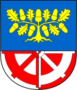
Bílá Lhota
| Bilá Lhota | ||||
|---|---|---|---|---|
|
||||
| Basic data | ||||
| State : |
|
|||
| Region : | Olomoucký kraj | |||
| District : | Olomouc | |||
| Area : | 1822 ha | |||
| Geographic location : | 49 ° 43 ' N , 16 ° 59' E | |||
| Height: | 395 m nm | |||
| Residents : | 1,137 (Jan 1, 2019) | |||
| Postal code : | 783 24 - 783 26 | |||
| License plate : | M. | |||
| traffic | ||||
| Street: | Loštice - Litovel | |||
| structure | ||||
| Status: | local community | |||
| Districts: | 7th | |||
| administration | ||||
| Mayor : | Alena Sedlářová (status: 2014) | |||
| Address: | Bílá Lhota 1 783 21 Chudobín |
|||
| Municipality number: | 500623 | |||
| Website : | www.bilalhota.cz | |||
Bílá Lhota (German Weißöhlhütten ) is a municipality in the Czech Republic . It is located 24 kilometers northwest of the city center of Olomouc and belongs to the Okres Olomouc .
geography
Bílá Lhota is on the right side of the March on the edge of the Litovelské Pomoraví protected landscape area in the northern foothills of the Drahaner Bergland . The Třesín (345 meters) rises to the east .
The R 35 / E 442 expressway runs to the northeast .
Neighboring towns are Kozílek and Řimice in the north, Měník and Mladeč in the east, Měrotín in the south-east, Hradečná, Pateřín and Kovářov in the south, Olešnice in the south-west, Hrabí in the west and Trpín and Červená Lhota in the north-west.
history
Bílá Lhota was first mentioned in a document in 1350. The Řimice district, which has been documented since 1281, is older.
After the abolition of patrimonial , Bílá Lhota belonged to the Littau / Okres Litovel district from 1850. After its dissolution, the village came to Okres Olomouc in 1961. In the same year, the incorporation of Hrabí, Hradečná and Pateřín took place. On October 23, 1976, Řimice with its districts Červená Lhota, Měník and Nové Mlýny was incorporated into Bílá Lhota.
Local division
The municipality of Bílá Lhota consists of the districts Bílá Lhota ( Weißöhlhütten ), Červená Lhota ( Rothöhlhütten ), Hrabí ( Hag ), Hradečná ( Hradeschna ), Měník ( Mienik ), Pateřín ( Paterschin ) and Řimice ( Rimnitz ). Basic settlement units are Bílá Lhota, Červená Lhota, Hrabí, Hradečná, Měník, Nové Mlýny ( Neumühle ), Pateřín, Řimice and Trpín.
The municipality is divided into the cadastral districts of Bílá Lhota, Červená Lhota u Řimic, Hrabí, Hradečná u Bílé Lhoty, Měník, Pateřín and Řimice.
Attractions
- Arboretum
- Bílá Lhota Castle. The composer Conradin Kreutzer - who was second married to Anna Speil von Ostheim (1802–1886) - composed a number of his most important works in the palace in the early 1830s , including Melusina based on Franz Grillparzer's libretto (originally written for Beethoven ) and Das Nachtlager in Granada .
- church
- Chapel of Our Lady of the Rosary on Měník's village square
- Chapel of St. Cyril and Methodius, on the road between Měník and Řimice
Web links
Individual evidence
- ↑ http://www.uir.cz/obec/500623/Bila-Lhota
- ↑ Český statistický úřad - The population of the Czech municipalities as of January 1, 2019 (PDF; 7.4 MiB)
- ↑ http://www.uir.cz/casti-obce-obec/500623/Obec-Bila-Lhota
- ↑ http://www.uir.cz/zsj-obec/500623/Obec-Bila-Lhota
- ↑ http://www.uir.cz/katastralni-uzemi-obec/500623/Obec-Bila-Lhota


